
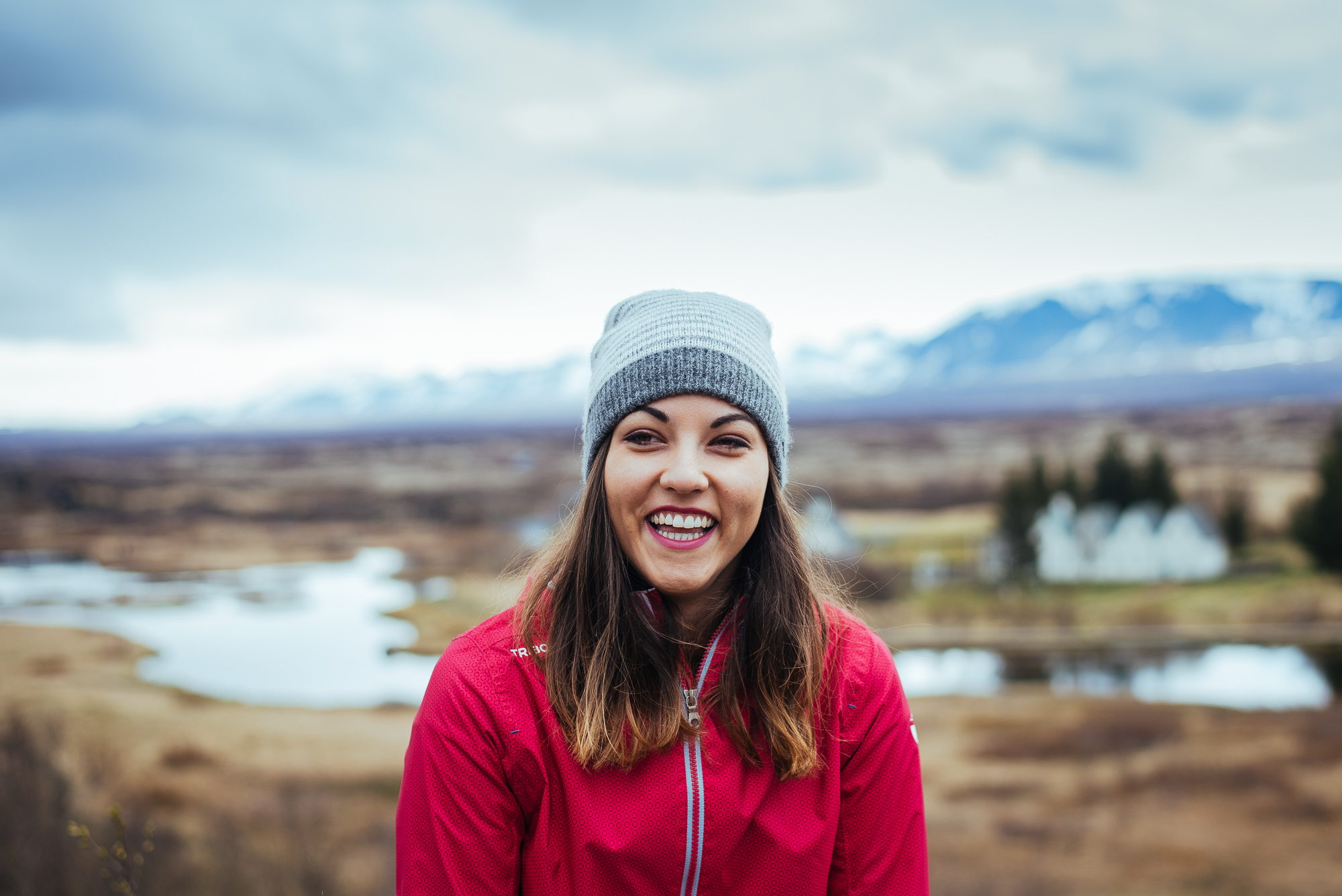
Two weeks in Iceland. Just enough time to circle around it. We bought three plane tickets in December. I caught a promo flight from Zagreb to Keflavik for roughly 270 EUR which sounded pretty good at the time. There were a few stopovers, but nothing too lengthy.
Then we had six months of planning ahead. Naturally we were on a budget and Iceland is pretty expensive, however with some research and a few tricks we didn’t really spend all that much. We decided to do the Ring Road - Route 1 with some extras and some exceptions. Overall we skipped Westfjords, the northeastern part and the interior. Another time then.

June means the start of summer and transition from low season to high, so prices can vary. We visited the land of ice and fire in the first half of the month, which some still consider low season so we took advantage of those providers. Geysir car rental gave us a nice car and an even nicer free upgrade later. We got a discount for early-birding it and an extra free “late” pickup. We paid 630 EUR for two weeks with a brand new, fuel efficient Hyundai with gravel protection and super CDW. There's also Sadcars car rental, which should be the cheapest, but the cars really are sad :)
Next: accommodation. The best bargain would be camping, but we weren’t going to take that chance with the shifty weather and all. The next best option were hostels, specifically dorms. We started in a nice Airbnb in Reykjavik and continued in hostels throughout the whole trip. It’s essential to pick hostels with self-catering kitchen. This way you can go shopping for food (Bonus, Kronan or Netto stores) and cook for yourself. Accommodation cost us 30 EUR per person per night in average.
We arrived at Keflavik airport at 23:00, bought a couple of beers, picked up our car and rushed to Reykjavik. Our kind Airbnb host was waiting to show us the flat. It was located 5-10 minutes from the city centre and very close to the waterfront. It was late and still bright outside, we were exhausted and fell asleep right away.
Day 1
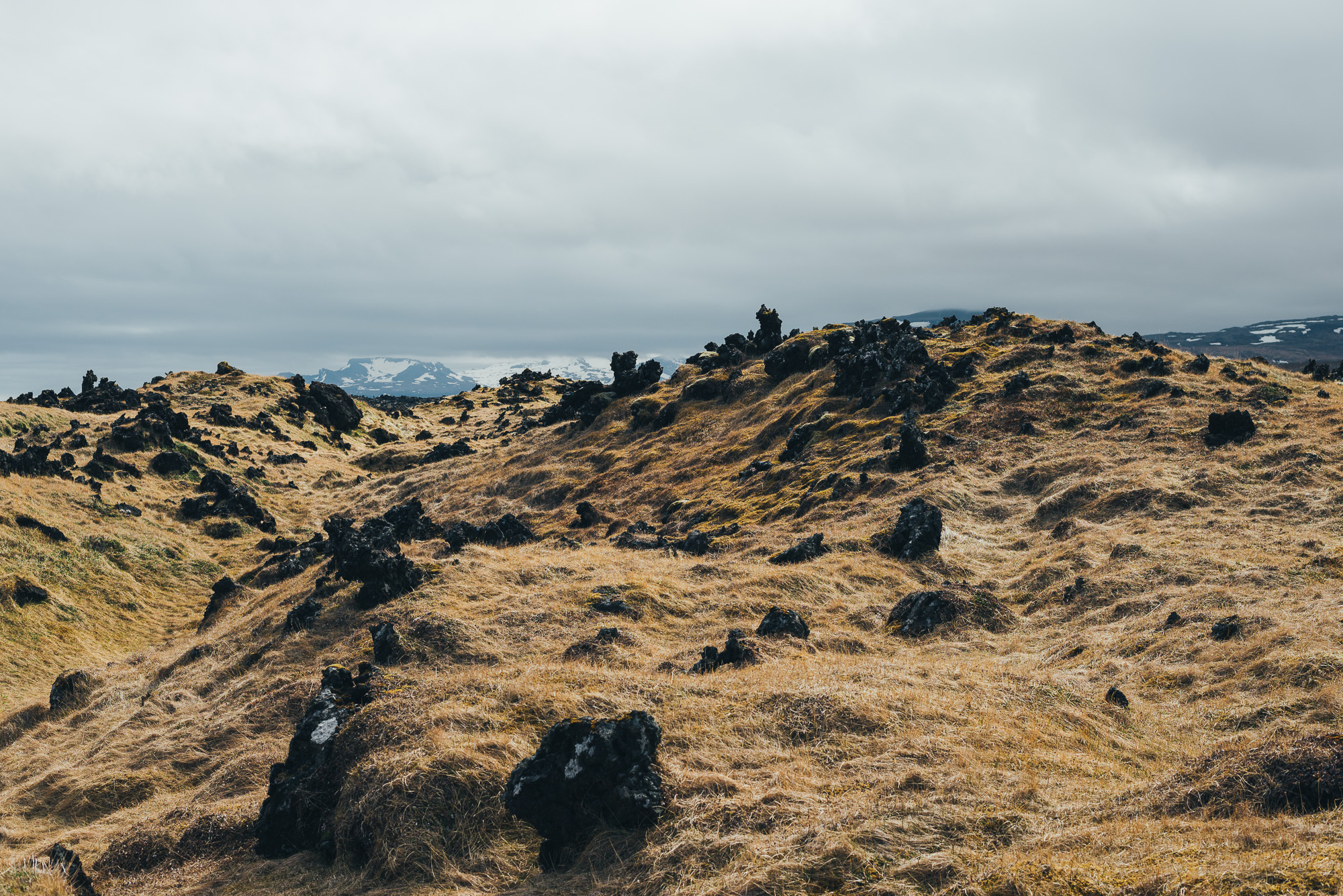
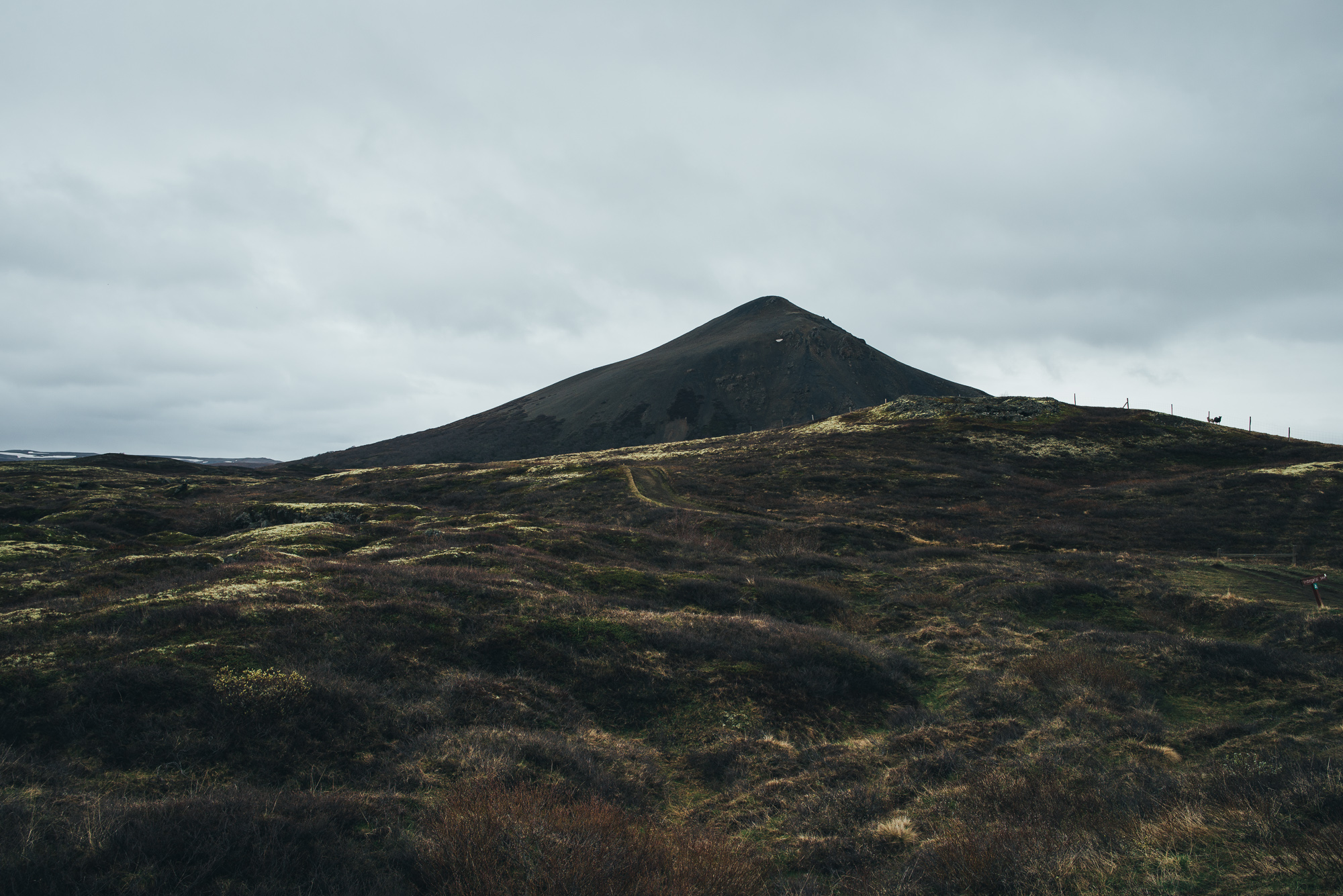
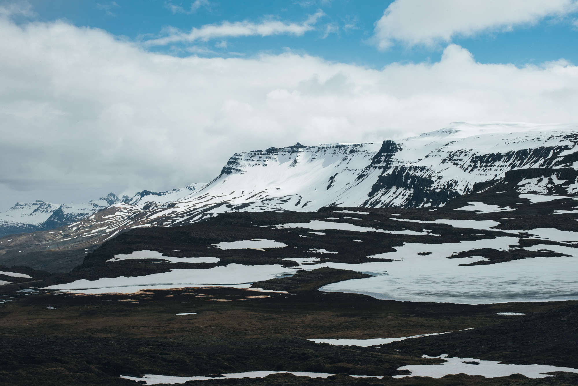
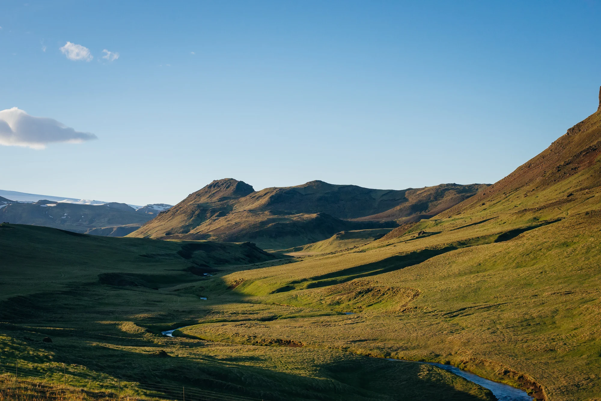
Official beginning of our journey around Iceland. We started our trip with a very accessible Reykjanes, a peninsula situated at the southwestern end of Iceland. Reykjanes is defined by its large lava fields, numerous hot springs, geothermal energy and rugged, barren landscape. It’s so sparsely populated that lighthouses supposedly outnumber villages.
I woke up first and went to check the northern Reykjavik waterfront - we were quite close to the Sun Voyager. It was a fresh and clear day. Icelandic air is as fresh as it gets.
Breakfast. We visited a local store to buy some water and sandwiches - the only time we bought water, you can drink it from just about anywhere. Tap water is also fine. It smells funny though.


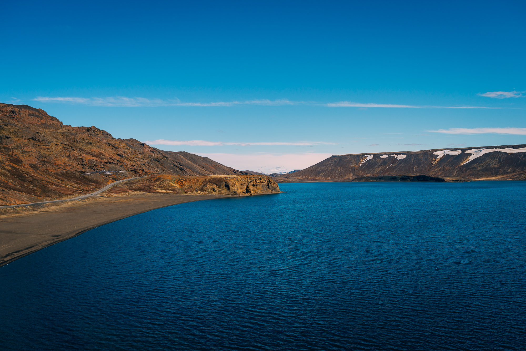
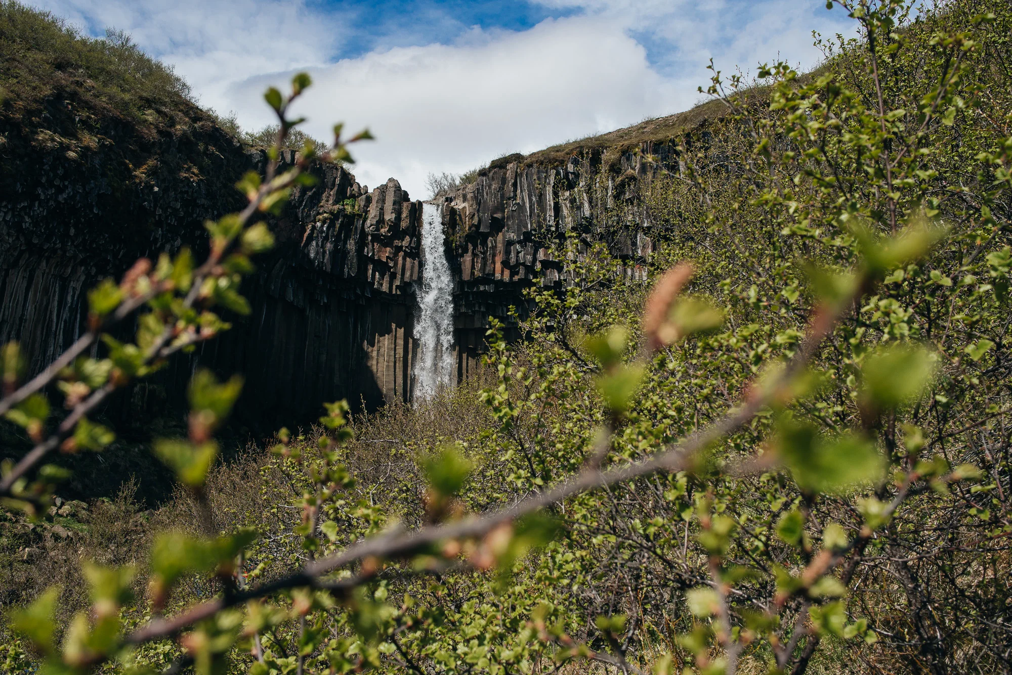
Lake Kleifarvatn.
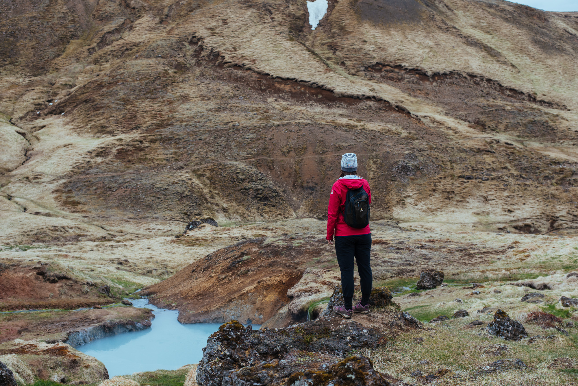
The Route 41 took us southwest from Reykjavik, where we turned left through arid hills and made our first stop at Kleifarvatn - the lake on the fissure zone of the Mid-Atlantic ridge. Beautiful landscape, blue water, sandy beaches and cliffs make you want to chill in the sun for hours. But there’s more to see. We didn’t go far to find the geothermal field Seltún, a part of Krýsuvík geothermal area. Seltún is a sloped area with solfataras, fumaroles, mud pots, hot springs and wooden paths leading through. Stick to the pathways, people :)


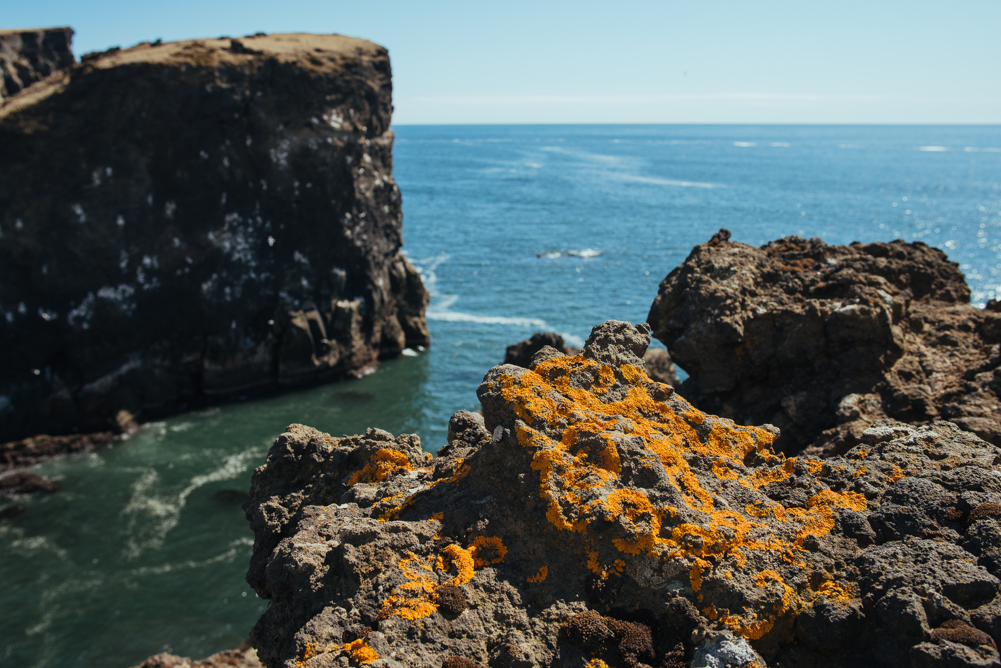
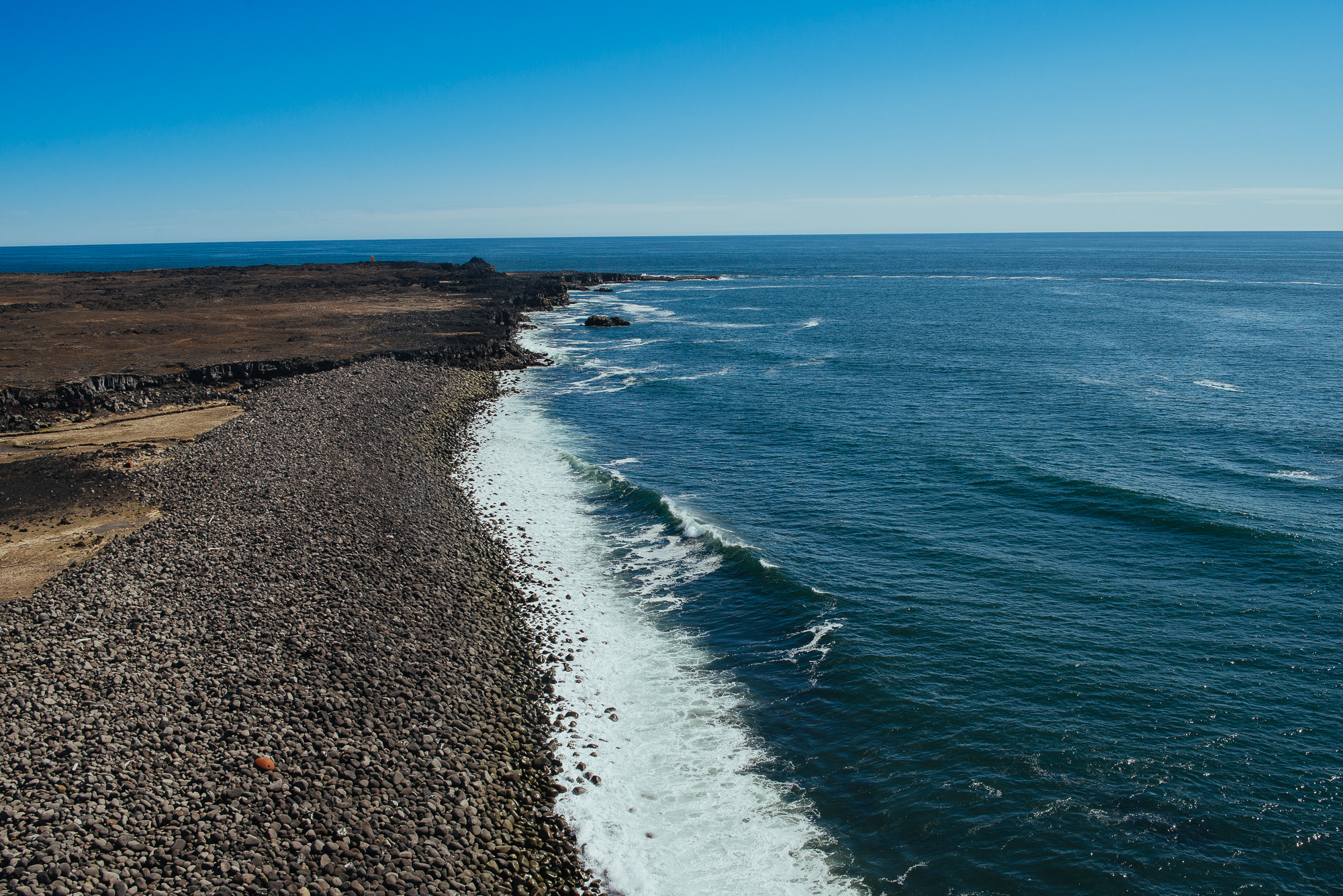
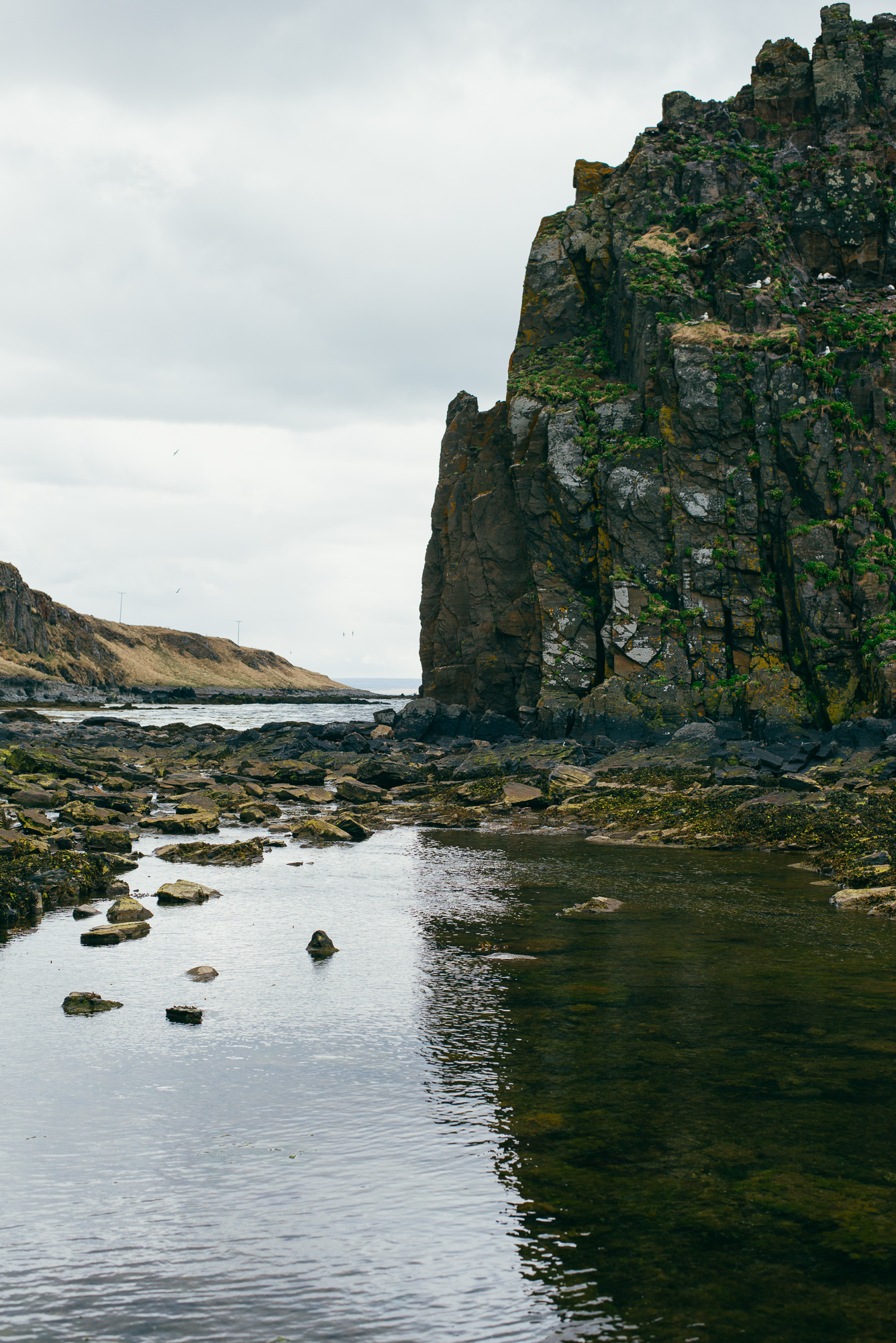
We then passed Grænavatn, an explosion crater with an exceptionally green hue. The road led us to the southern coast of the peninsula through Grindavik and on to Gunnuhver, a highly active geothermal area of mud pools and steam vents. That was on our way to Reykjanesviti, the oldest lighthouse in Iceland. We spotted the coastline and continued on foot to reach the cliffs. An amazing scene welcomed us there - it was very windy like most of the time, hundreds of seagulls were gliding around us and waves were eating away the rocky beach.


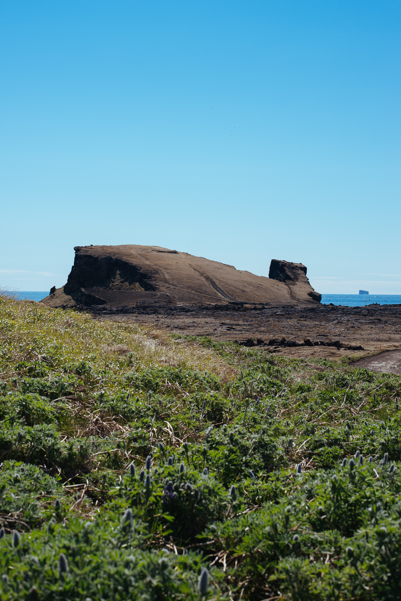

Cliffs at the western end of Reykjanes peninsula.


The lava-scarred Reykjanes peninsula lies on one of the world's major plate boundaries, the Mid Atlantic Ridge. The Eurasian and North American tectonic plates are continuously drifting apart. As the plates diverge, fissures form due to stresses created by the tension that builds up as the plates move away from each other. The bridge between two continents (Leif the Lucky Bridge) at Sandvík is a small footbridge allowing you to cross between Europe and North America. There was nothing really special about the bridge itself, still the whole tectonic plates thingy was very fascinating and it was following us through the whole trip.


We spent the evening in the capital, strolling through the cozy streets of Reykjavik to see the sights. Starting at Sólfar, passing the modern concert hall Harpa, town square of Austurvöllur and the Parliament House (Alþingishúsið) with neighbouring Domkirkjan (city's oldest church). We stopped at Tjörnin, passing Fríkirkjan and turned uphill towards the majestic Hallgrímskirkja. At 73 m tall and resembling the basalt lava flows of Iceland's landscape, it's indeed an extraordinary sight not to miss. Unfortunately we didn't go to the viewing deck as it was too late and the church was already closed. The view of Reykjavik from the top should be cool though.


Hallgrímskirkja.
Day 2
Our second day was about covering the Golden Circle, probably the most popular tourist route in Iceland. It's relatively close to the capital and combines the National park Þingvellir, hot springs area with Geysir and the waterfall Gullfoss. If you're on a tight schedule and can't really go far from the capital, Golden Circle makes for a nice day trip.
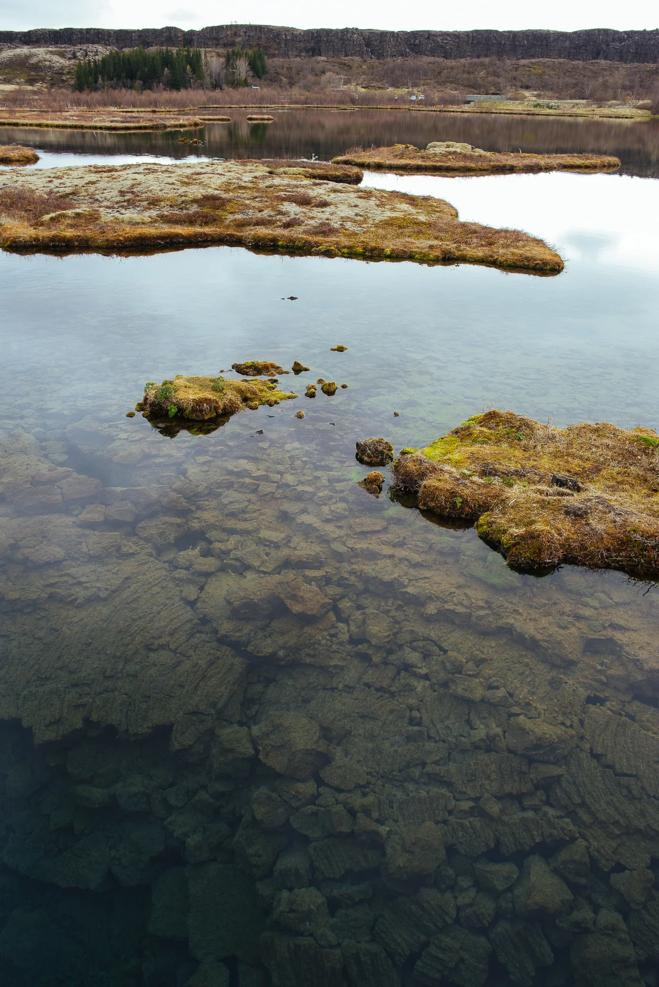
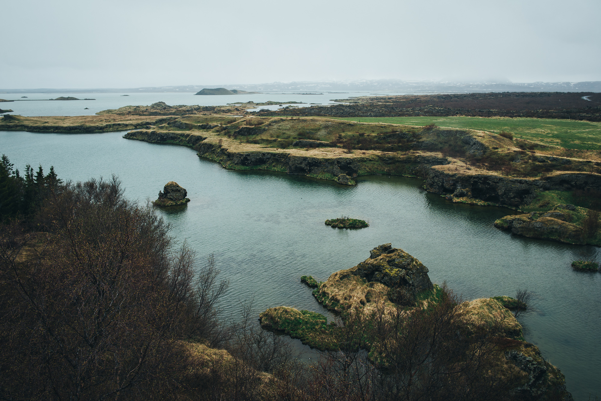
As soon as we drove north from Reykjavik on Route 36, the landscape was already so much different than Reykjanes. The grass was greener and landscape in general more lively. Our first stop was Þingvellir, a site of historical, cultural, and geological importance and one of the most popular tourist destinations in Iceland. It lies in a rift valley at the northern end of Þingvallavatn, the largest natural lake in Iceland. Þingvellir is a key location in Icelandic history as the oldest existing parliament in the world, first assembled there in 930 AD.

Þingvellir.


Waters flowing through Þingvellir are popular for fishing and scuba diving. Silfra, a rift filled with crystal clear water allows you to literally swim between continents and it offers amazing visibility.

Moving on to Geysir the weather got worse and started pouring like crazy. We had to wait for it to ease up a little and then go check the area. News flash - the Great Geysir doesn't really erupt all that often anymore - that's a common mislead. Strokkur is actually the MVP, erupting to heights of up to 30 metres every few minutes and it is awesome every single time. The area is packed with lots of other little hot springs, mud pots and fumaroles as well.


Hot dogs! This was the time we first tried the famous Icelandic hot dogs and weren't dissapointed. They're cheap and tasty.
Next stop - Golden Falls. We actually made our first stop before the waterfall to see the canyon, created by the river Hvítá. Huge ravine with mossy edges was in fact one of the highlights for me. No one around, just a small waterfall on the other side of the canyon. Perfect. We continued to Gullfoss parking - there were considerably more tourists, but I wouldn't call it crowded. Paths lead you on various sides of the waterfall to get a full appreciation of its strength. There's also an elevated viewing deck to see Gullfoss in its whole glory. The water flow is just mad, so powerful it’s spraying all around.


Gullfoss.

Gullfoss.
We turned back south and stopped at Geysir again as the weather cleared up. Continuing south on Rt. 35 we reached the volcanic crater lake Kerið, a red rock caldera formed about 6,500 years ago. It is oval, about 270 m long, 170 m wide and 55 m deep - the depth of the water at the bottom varies between 7 and 14 m.


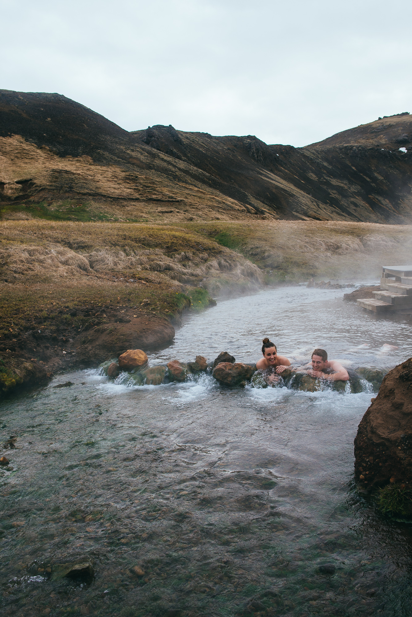
It was getting late so we set our course for Reykjavik with a stopover in Hveragerði, "hot springs capital of the world". Our initial plan was hiking in the Valley of Reykjadalur, which we gave up only to change our minds again and started the hike around 7h in the evening. We parked our car north of Hveragerði, where a nice couple encouraged us that “Steam valley” really is worth it. And it was. 40 minutes of hiking through barren valley with steam coming out of every hole, and we arrived at our destination. The hot springs were the perfect finale for the day. The higher you go, the hotter it is. Relaxing in the hot river was all we needed and could've stayed there all night. There are new wooden pathways along the river, which make for a bit touristy feel, but otherwise it's perfect.


Day 3
Time to clean up our Airbnb, check out and head west. Our destination was Grundarfjörður on Snæfellsnes peninsula where we booked our next night. But first - Glymur waterfall.
On our way to Hvalfjörður.
Looking back over Hvalfjörður.
Glymur.


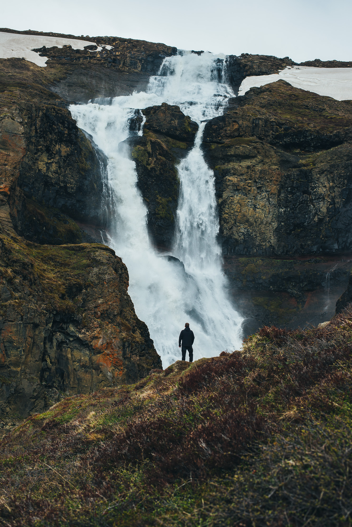
We started north from the capital on Rt. 1 and took Rt. 47 right along the Hvalfjörður. We reached the fjord’s end, turned right at Glymur sign and parked our car soon after that. An adventurous 1.5-hour hike to the top of the waterfall was a great experience. Crazy cliffs, birds everywhere and the view of the second highest waterfall of Iceland. With its 198 m it was long regarded as the highest until being surpassed with a new falls at Morsárjökull. It’s really hard to describe the feeling staring down a green, mossy wall into the canyon, kind of a surreal Jurassic Park moment. We crossed the ice cold river at the top, before the waterfall and made our way back on the western bank of the canyon. Another favourite for me.


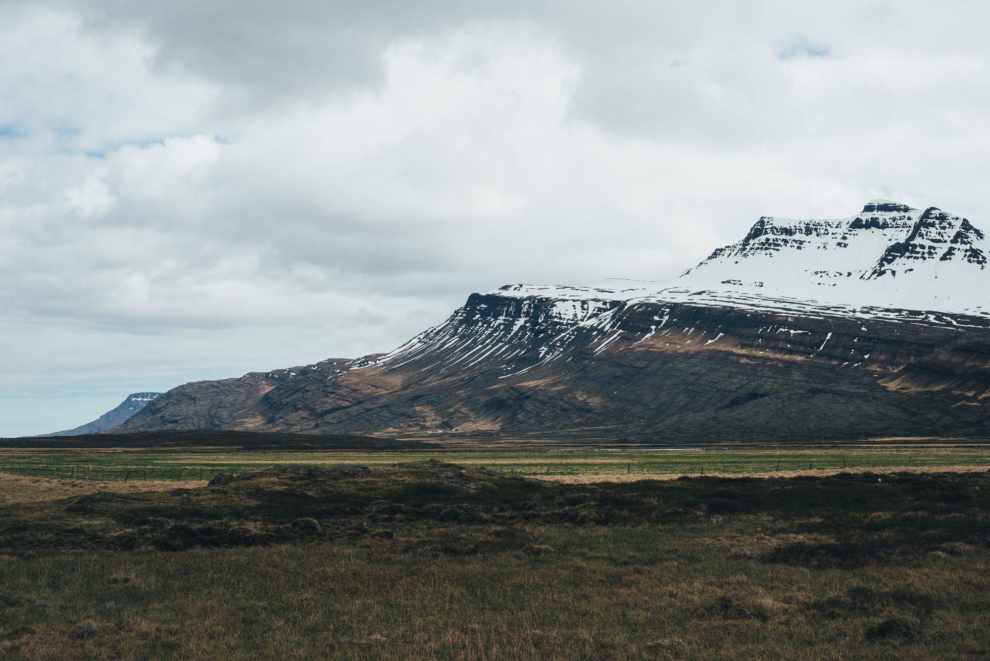
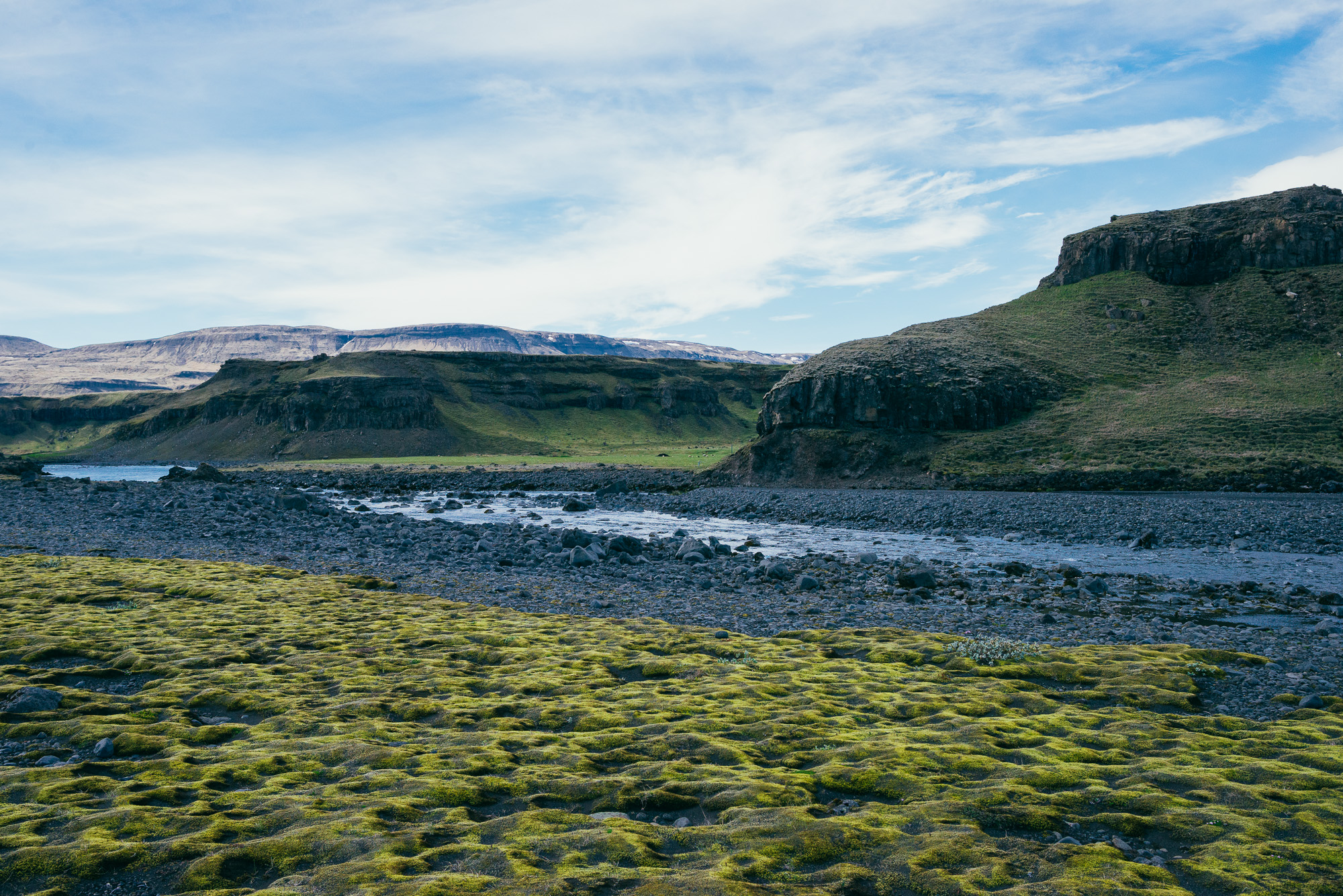
We had Hraunfossar and Barnafoss - two more waterfalls marked on our map, but we figured they’d be too much of a detour and continued west through Borgarnes. As we reached the Snæfellsnes peninsula, we stopped at Gerðuberg. There's a belt of 14 m high basalt columns that are just too geometric to be natural. We continued west on Rt. 54 and visited Ytri Tunga farm. The beach is a well-known seal colony and we really hoped to see them lying on the beach all fat, but there were only a few shy heads sticking out of the water and hiding as soon as we spotted them. It’s still a very nice spot with the beach, stream and snowy mountains in the back, so try your luck!
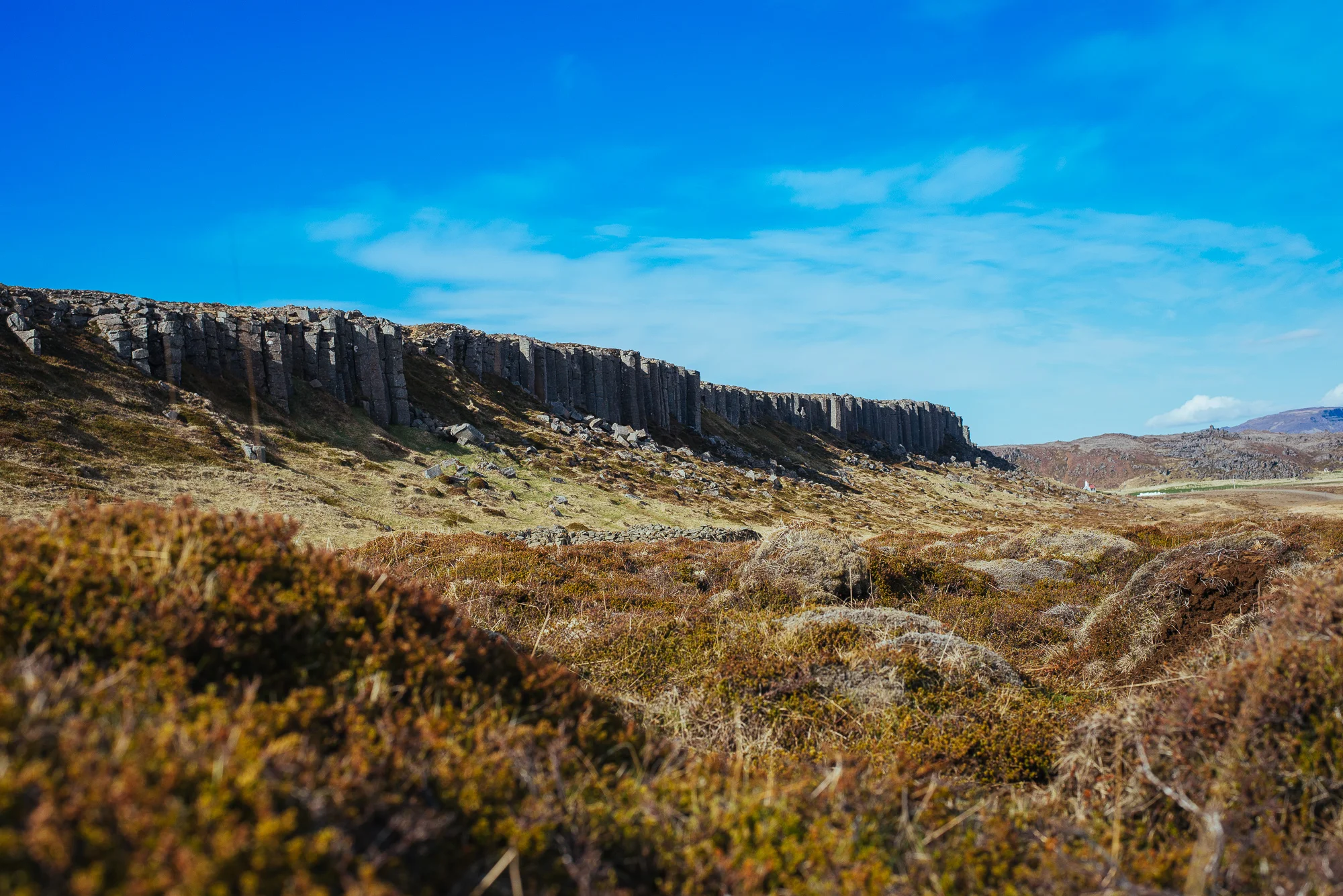
Gerðuberg basalt columns.


Driving through Snæfellsnes peninsula.


We crossed to the north side of Snæfellsnes with Rt. 56 and took in some beautiful evening scenery along the way. We reached the lovely Grundarfjörður quite late, had dinner, went for a sunset walk around and called it a day.


Day 4
Exploring Snæfellsnes peninsula. We headed west past Kirkjufell (the most photographed mountain in Iceland) through Ólafsvík, Hellisandur and entered the Snæfellsjökull National Park. We drove through rugged lava fields to the westernmost point of the peninsula. Svörtuloft lighthouse stands between an enormous lava bed with yellow patches of grass and violent cliffs. Again, hundreds of birds. It seems like literally every cliff in Iceland is a nesting place for birds. We also spotted an arctic fox running away from the road!
Lava field on Snæfellsnes peninsula.


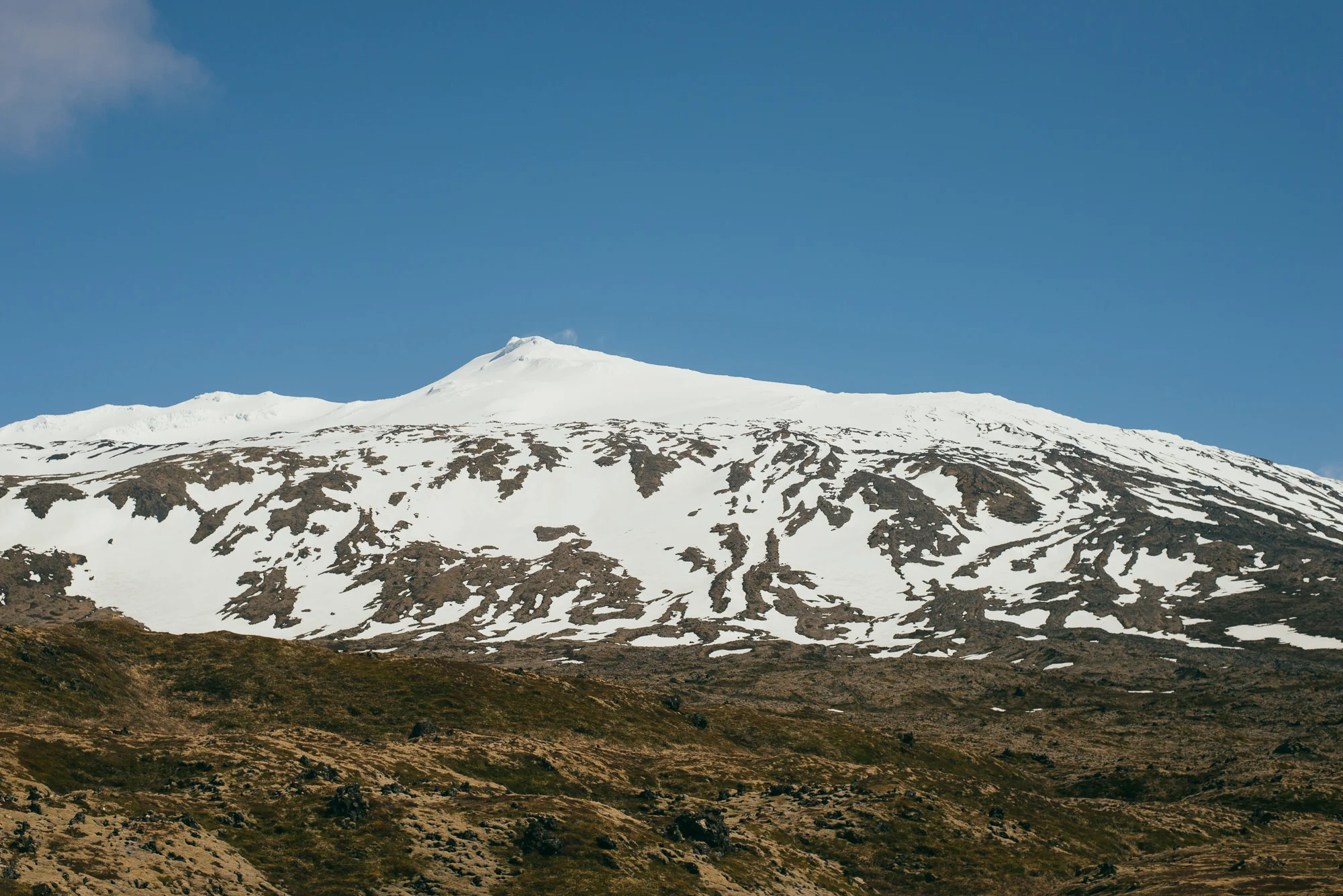
We drove on and passed a few craters on the way - Saxhóll Crater was a fine ascend. We circled around the mighty Snæfellsjökull, a 700,000-year-old stratovolcano with a glacier covering its summit and stopped at Hellnar for a cup of coffee on the shore. A lovely fishing village with spectacular rock formations on the beach. There's a hiking trail leading through the lava field between Hellnar and the second fishing village Arnarstapi, which should be great, however we drove around to save some time. Arnarstapi is also a delightful place with a harbour around fascinating cliff formations.


View over Snæfellsjökull from Arnarstapi.


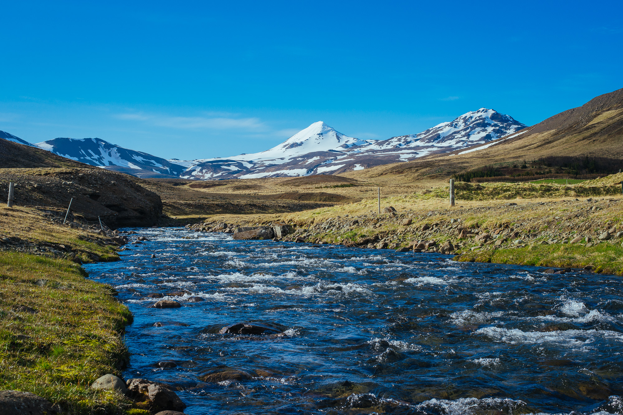
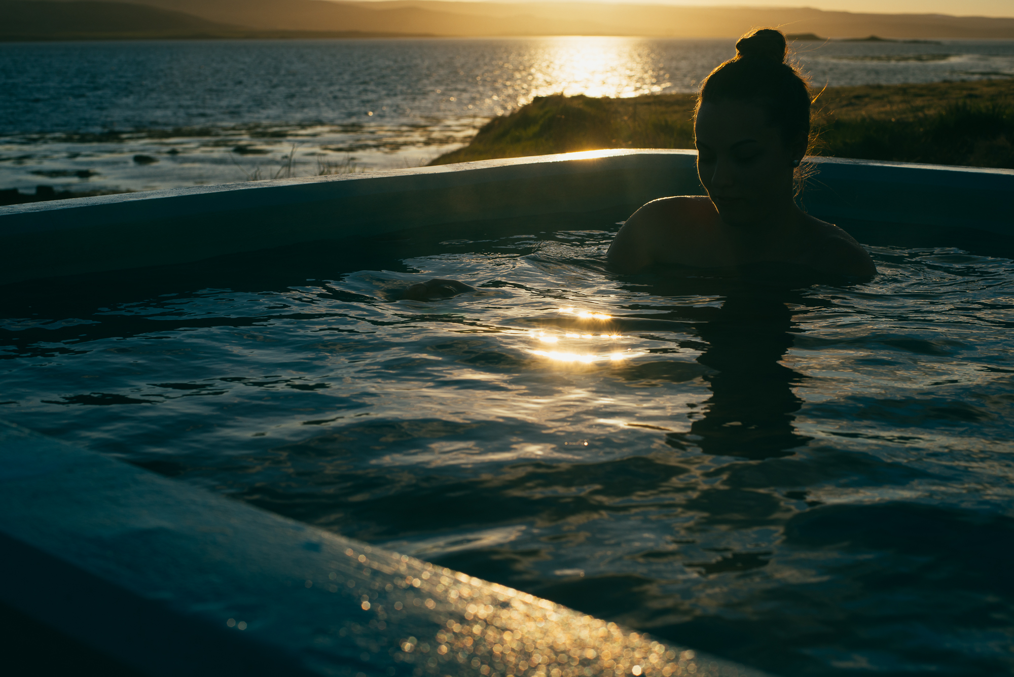
We drove past Rauðfeldsgjá gorge and visited Búðir to see the famous hotel and get a shot of the little old church surrounded by Búðahraun lavafield. After that we gave Ytri Tunga's seals another chance, but again had little luck spotting them. We headed way up north to Sæberg Hostel in Hrútafjörður, cutting off the Westfjords entirely. Sæberg was one of our favourite hostels with great location and a private hot pool with a view over the fjord. We naturally spent the sunset in the pool.


Day 5
Continuing our clockwise circle around Iceland, we departed from Hrútafjörður and moved to Miðfjörður on Rt. 711. Shores north of Hvammstangi are famous for seal colonies - again no luck with the wildlife but amazing coastline nonetheless. We turned back and checked out Kolugljúfur gorge with its cascading waterfalls, crossed a massive black beach and ended up in Hofsós - a uniquely colored town with a harbour and a pool overlooking the sea. If you descend down the path leading to the shore, you reach some amazing sea-polished basalt columns. Moving up the Tröllaskagi peninsula we stopped for lunch and a random grey head was lurking out of the water every now and then - it was a grey seal and this time we were sure :)


Miklavatn.

Héðinsfjarðarvatn.
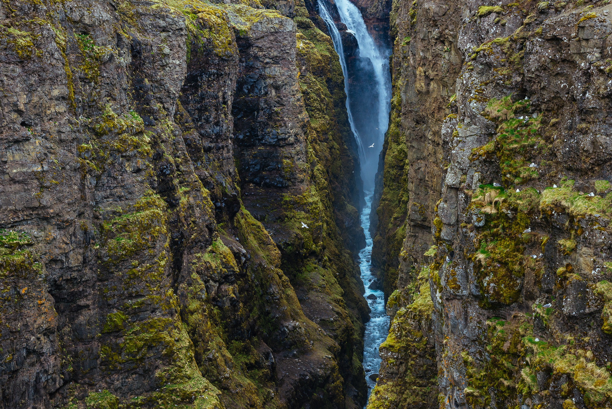
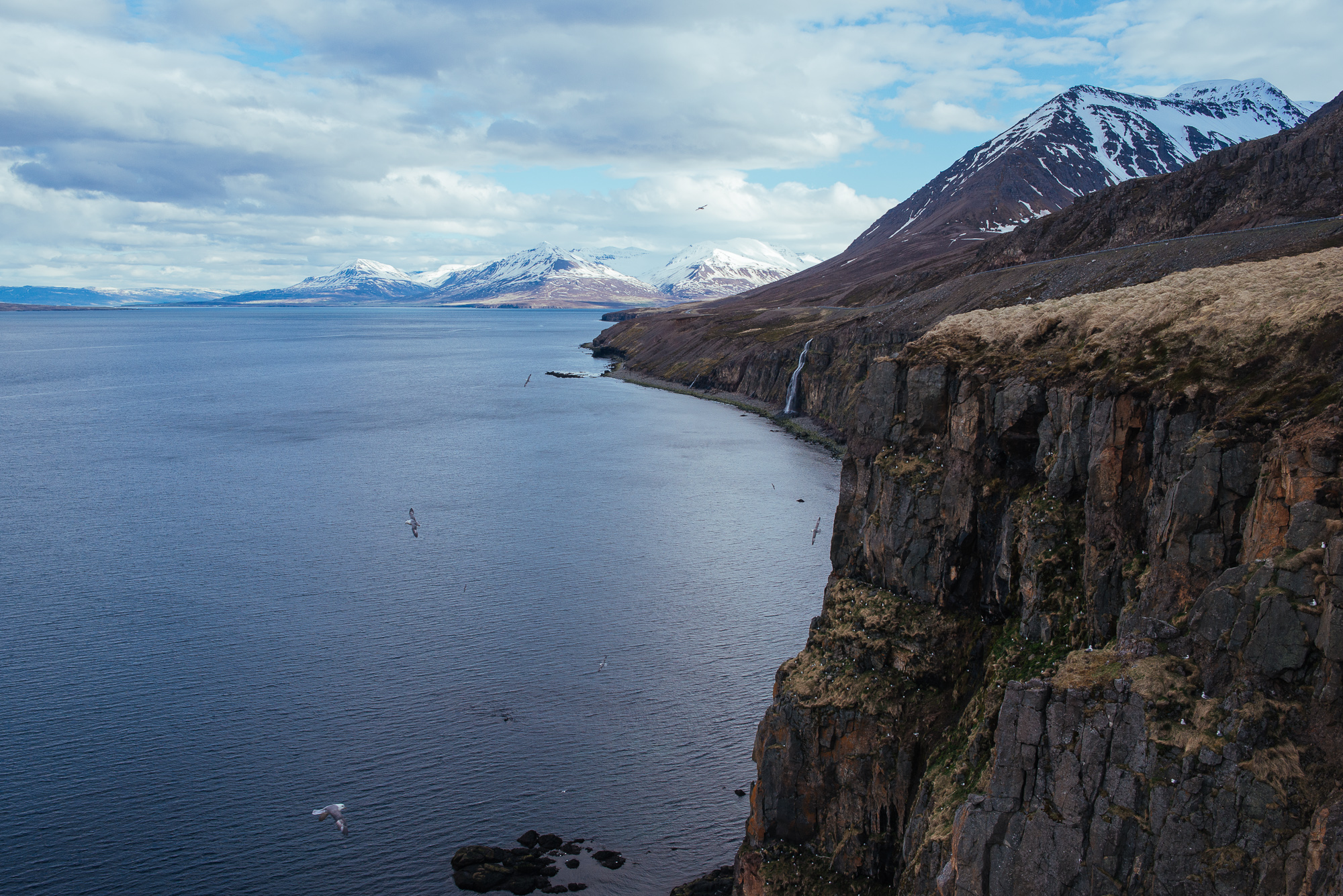
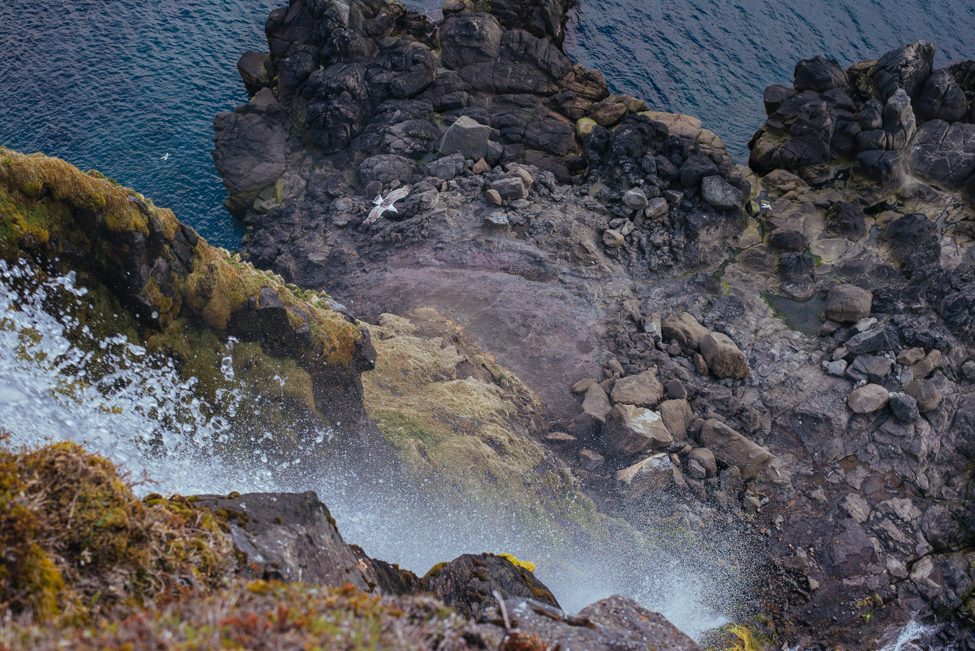
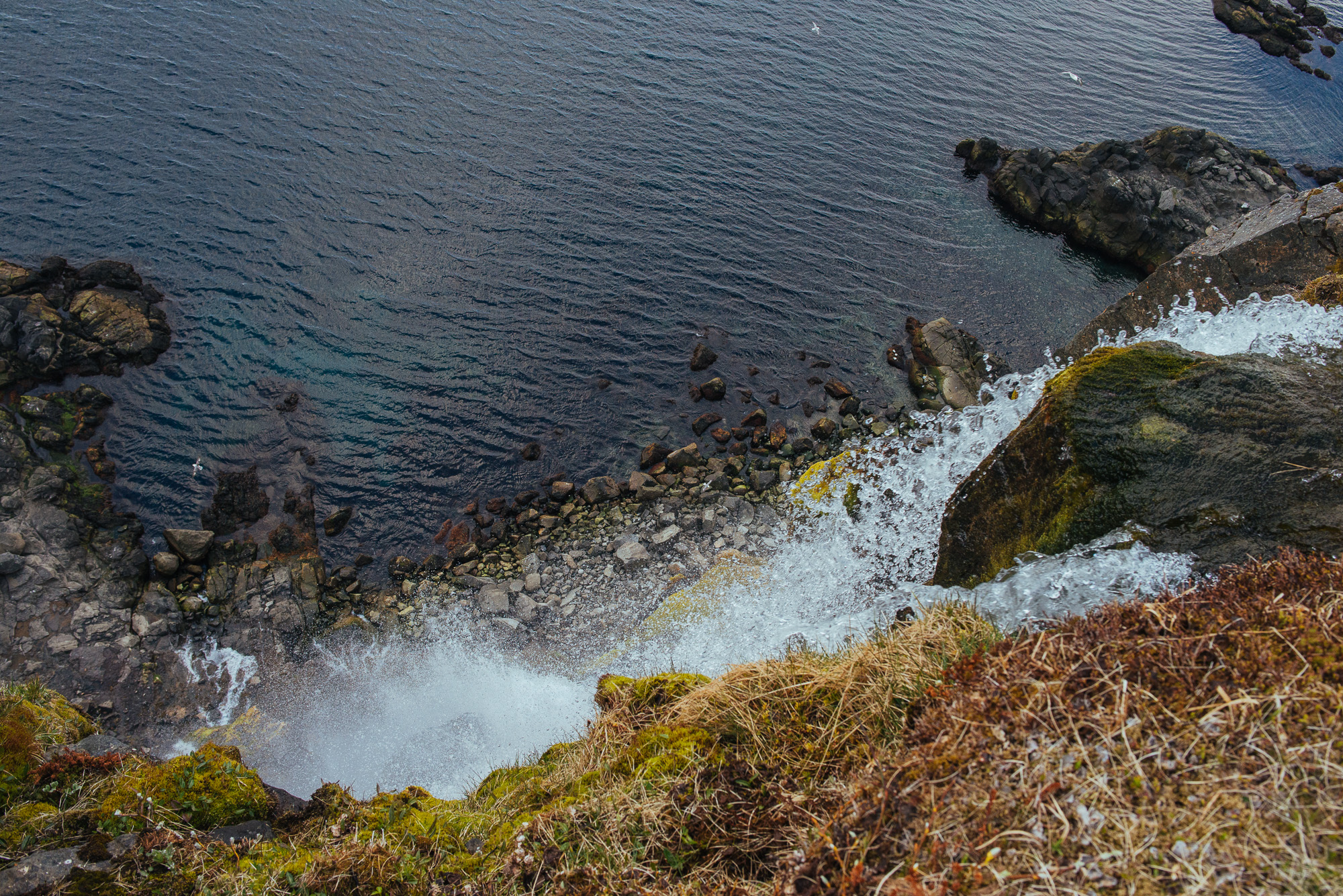
We continued passing fjord by fjord - Siglufjörður, Ólafsfjörður, driving through the creepy tunnels when finally catching that vista of Eyjafjörður. Our next hostel was in Dalvík but we made a stop a few kilometres before the town and followed a stream towards the cliff. The stream turned into a waterfall plummeting down. What a sight. Definitely a highlight. More waterfalls on the left, even more on the right, calm sea below us, seagulls flying around and blowing wind gave us a pristine feeling of freedom. Fuck yeah! We reached the seaside town Dalvík and our host Bjarni gave us a warm welcome.
Day 6
Whale-watching day with Arctic Sea Tours in Dalvík. I purchased the tickets in advance for 8550 ISK per person and got a minor discount. It was 9h in the morning, we put on some warm overalls and boarded our boat. It was super windy and cold, we'd be gone without their overalls! We haven't spotted anything for two hours and it didn't look good. However we did encounter 2 humpback whales later - our guides said they were shy as they kept swimming away. We slowly kept following them, caught a few blows, a dorsal fin here and there and an occasional fluke, but quite distant.


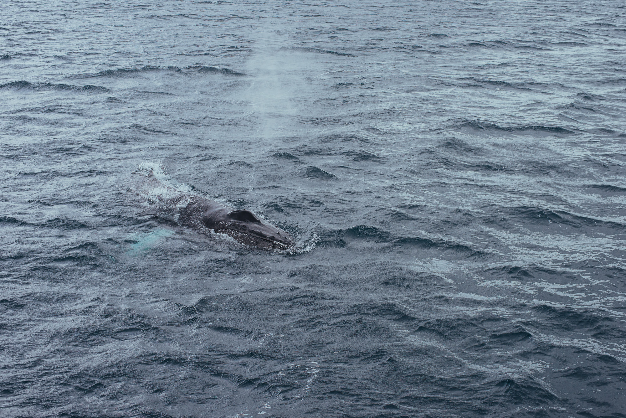

We stopped at Hjalteyri, a small village between Dalvík and Akureyri, which was the end of our trip, however they offered us a way back and another 3hrs of whale watching free of charge since we didn't see much. The way back was better - one humpback came pretty close to our boat and swam around us a few times, so we got a better sense of its size. It's huge. There are supposed to be quite a few other species of whales around Iceland; white-beaked dolphins, minke whales, small harbor porpoises and sometimes even the majestic blue whale. Most whale watching companies pride themselves in 98-99% chance of spotting a whale. We even went sea angling and tried cod fish when we returned. All in all it was a fun adventure, though I wouldn't mind a breach or two :)


Our Dalvík experience was over, we packed up and moved on to check out Goðafoss (Waterfall of the gods). It is a 30 m wide, 14 m high waterfall forming separate cascades. Goðafoss is closely connected to one of the most important events in Icelandic history, the conversion to Christianity in the year 1000. Lawspeaker Þorgeir Ljósvetningagoði allegedly threw his statues of the Norse gods into the waterfall after making Christianity the official religion.

Goðafoss.


We ended our day at Árbót Hostel with a view over the beautiful Aðaldalur valley, our home for the next 4 nights, while we were exploring the area around lake Mývatn - The Diamond circle.
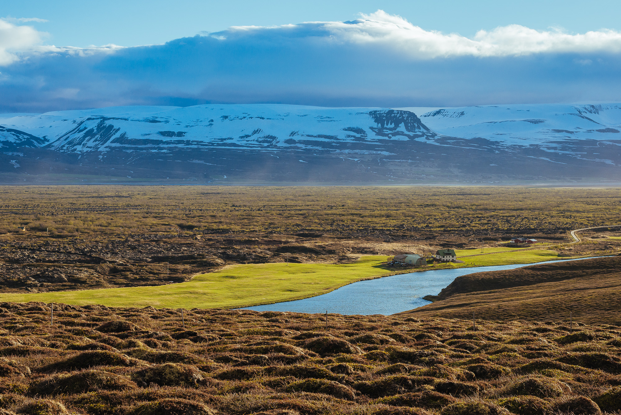
Aðaldalur.
Day 7
We woke up to a beautiful day, ate some breakfast and headed to Húsavík, the Whale Watching Capital of Europe, to start the Diamond circle. We first visited the amazing whale museum with interesting information about whales and their habitat. With 1.600 m2 of exhibition area in two stories, the museum offers everything from history, ecology, strandings, whale watching, Icelandic whaling and more. The museum’s upper floor contains the “whale gallery” with authentic skeletons of 9 species.


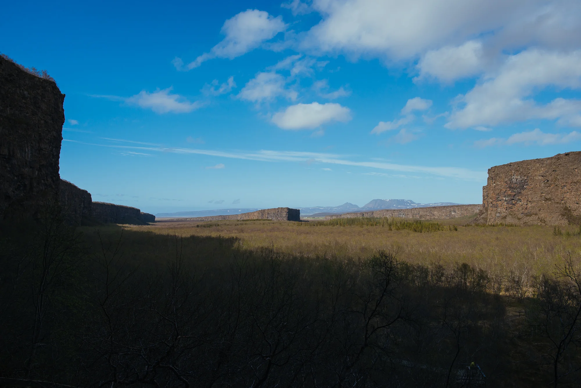
We later took a walk around Húsavík - colourful houses and stunning snowcapped peaks across the bay prove it to be one of the prettiest northern fishing towns. We continued driving around Tjörnes peninsula, stopped at a viewpoint on Rt. 85, crossed a black beach and visited Ásbyrgi which is already a part of the Vatnajökull National Park. Ásbyrgi is a horseshoe-shaped canyon with cliffs up to 100 metres in height. It's divided through the middle by a distinctive rock formation called Eyjan - the Island. The legend says that the canyon was formed when Odin's eight-legged horse, Sleipnir, touched the ground.

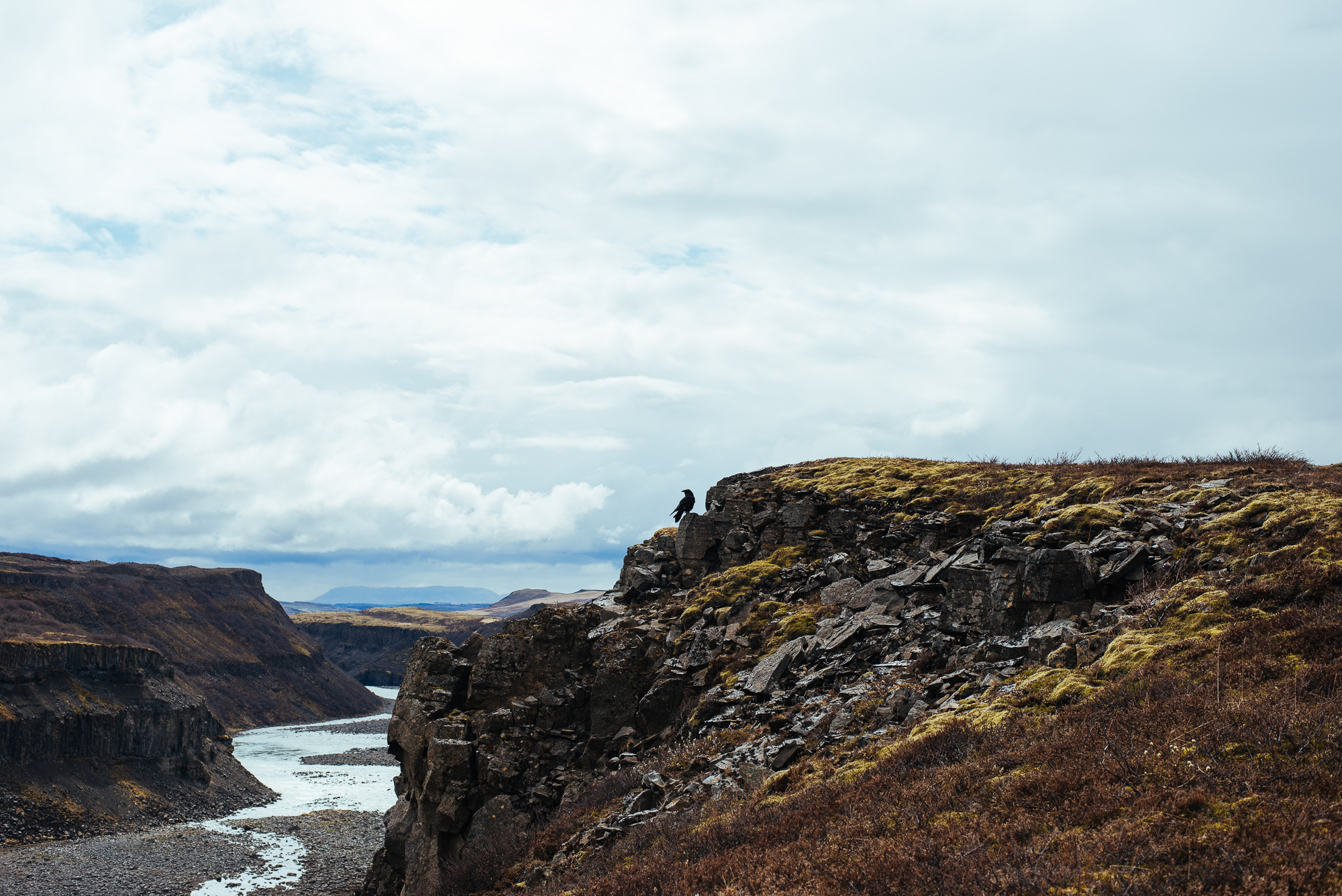
We then caught a glimpse of Jökulsá á Fjöllum, the second longest river (206 km) in Iceland and home to Selfoss, Dettifoss, and Hafragilsfoss, the second of which is the most powerful waterfall in Europe. River's source is the Vatnajökull glacier itself.
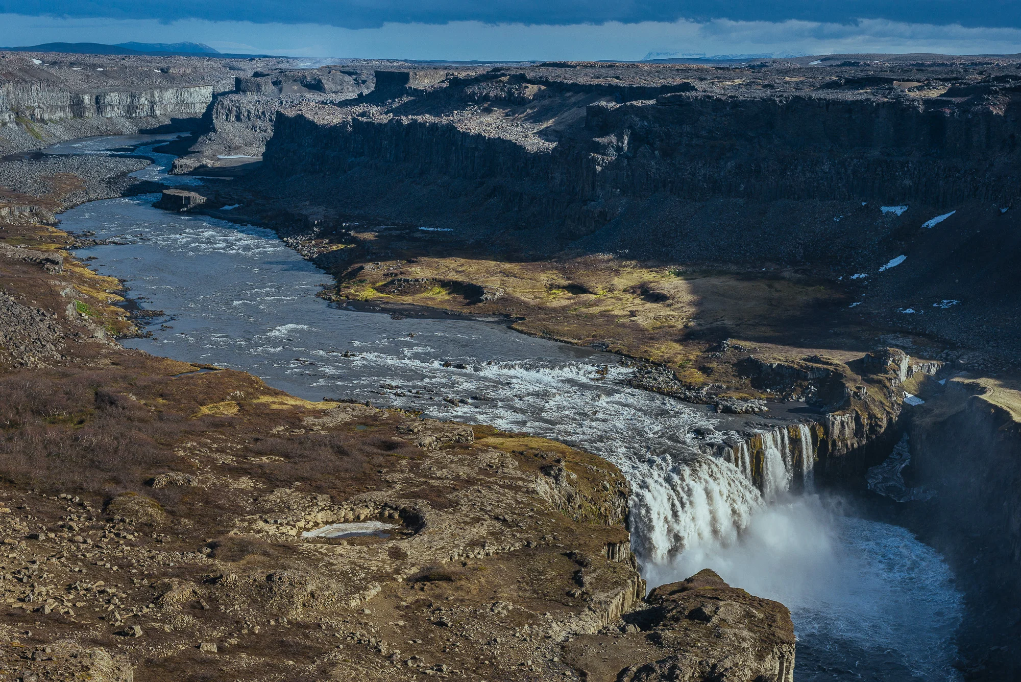

We left Rt. 85 for a gravel road 864 and drove on the eastern bank of the mighty river. Route 864 got worse every with every turn and it took quite a while to get anywhere with our car. Our first stop was Hafragilsfoss - the observation point puts you way up, high above the waterfall and the view is spectacular. You can already see the mist upstream, where Dettifoss rumbles. But the road got even worse. We managed to park the car and approached Dettifoss. Falling 45 m at a width of 100 m with an average flow of 193 cubic meters per second, it really blows you away. Waterfall's mist even forms tiny new falls on the adjascent wall.
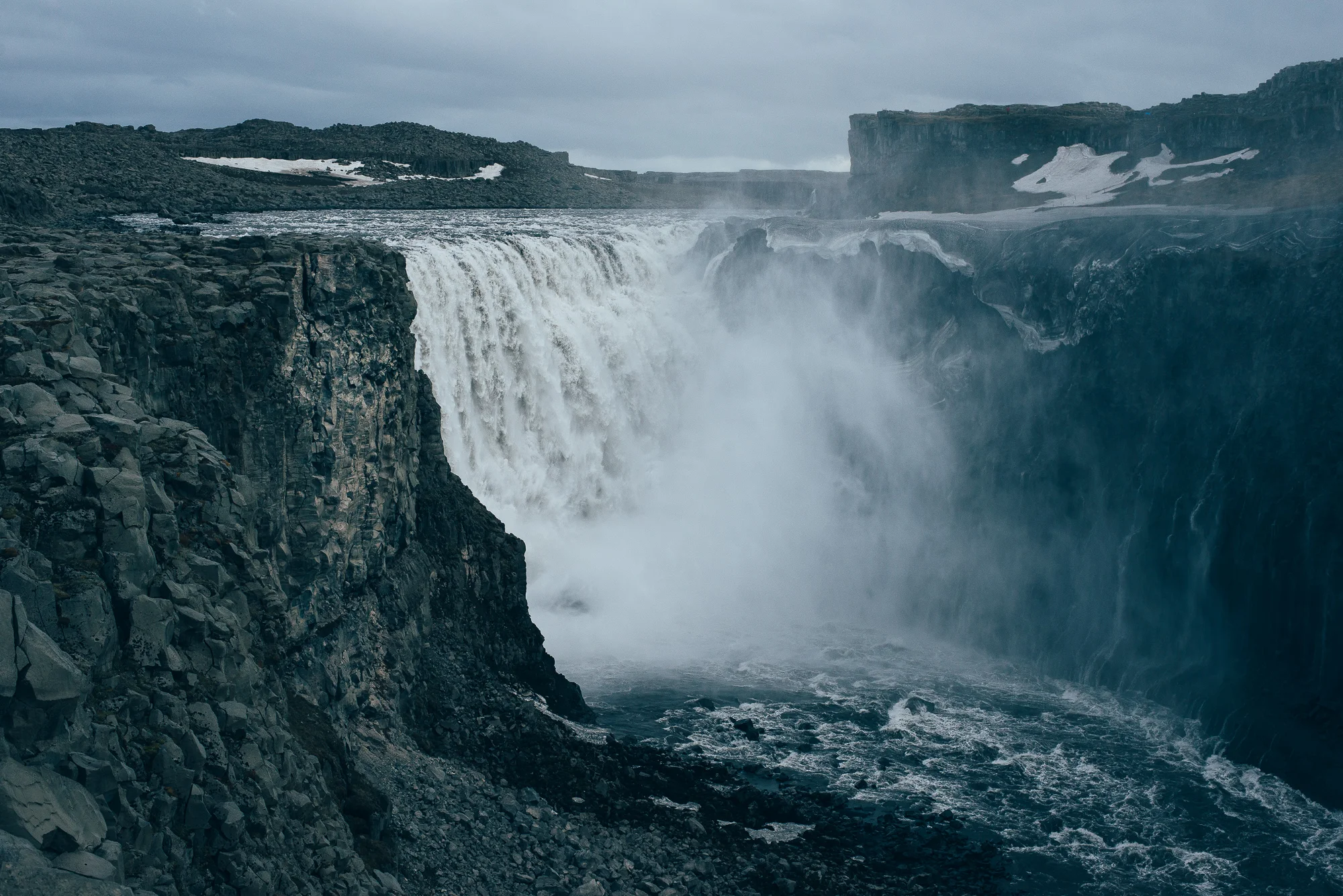
Dettifoss.


North Iceland.
Days 8 and 9
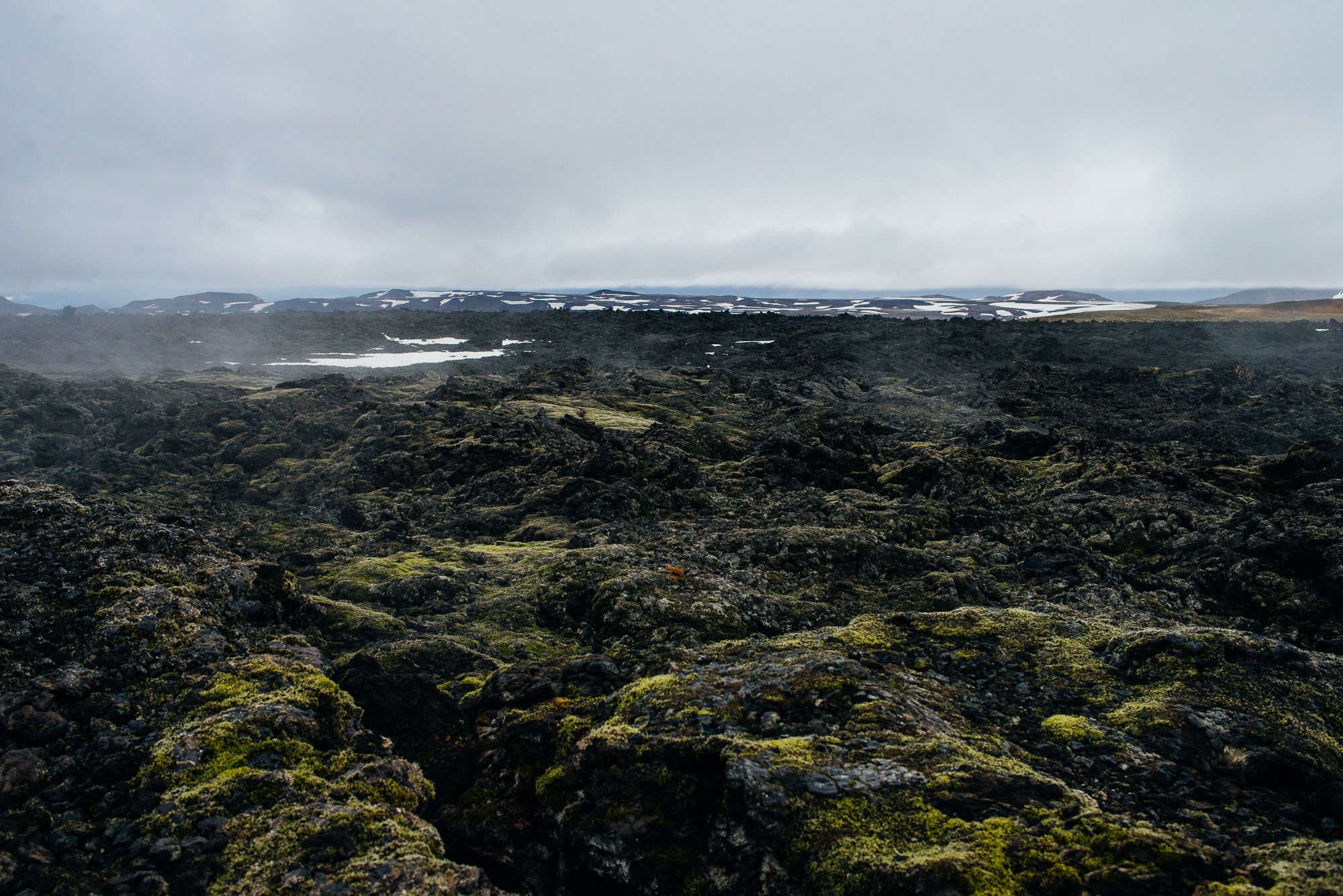
Two days around lake Mývatn, having some bad weather - constantly cloudy with rain. That didn't stop us though. We visited lake Mývatn, drove through a lava field and had a cup of coffee in Reykjahlíð, a tiny village in northeastern part of the lake. We then ascended Hverfjall crater, created 2,500 years ago and 1 km in diameter. One can enjoy a nice view over Mývatn lake on Hverfjall's rim. Mývatn is known and even named after huge numbers of midges and our hike on Hverfjall was no exception, we literally had to spit them out. Just a short ride south and we stopped at Dimmuborgir (Dark Castles), a large area of unusually shaped lava fields, composed of various volcanic caves and rock formations. The dramatic structures are one of Iceland's most popular natural attractions.


Hverfjall.
We continued east towards Mt. Namafjal, under which lies the geothermal field Hverir. Consisting of stinking steam vents, solfataras and boiling mud pits, it's very similar to Seltún (Reykjanes). We passed the Leirbotn power station and continued uphill towards Krafla, a caldera of about 10 km in diameter with a 90 km long fissure zone. The area has been intermittently erupting for the last 3,000 years and shows no signs of cooling down yet. Krafla volcano itself was last active in the 1720s during a period known as the Mývatn Fires, which began when the west side of Krafla exploded, forming a new crater named Víti (meaning 'Hell'). The road ends at a car park in front of Víti, now a deep, aquamarine crater lake. West of Krafla is Leirhnjúkur, an utterly black lavafield. A marked walking trail leads through moss covered and steaming lava rocks. The atmosphere is still warm.

Hverir.


The next day was another mix of Diamond circle attractions. We started by wandering around pseudocraters in the south and climbed Vindbelgjarfjall on the eastern bank on the lake. With its 529 m above sea level, it offers great views, however fog and clouds prevented us from seeing much. We finished our wander at Mývatn Nature baths, Northern Iceland's answer to the Blue Lagoon. Relaxing in a distinctively blue pool of geothermal water did it for us.

Mývatn.


View from Vindbelgjarfjall.


Day 10
Driving on Route 1. This was the longest distance we had to cover in a single ride - 400 km of amazing scenery from Aðaldalur valley to Höfn í Hornafirði. We got caught in a minor snowstorm and passed the beautiful Rjukandi waterfall just by the main road, we filled our gas tank in Egilsstaðir, spotted wild reindeer and crossed a mountain pass to get to the east.
Aðaldalur.


Rjukandi waterfall.


Crossing to the east.


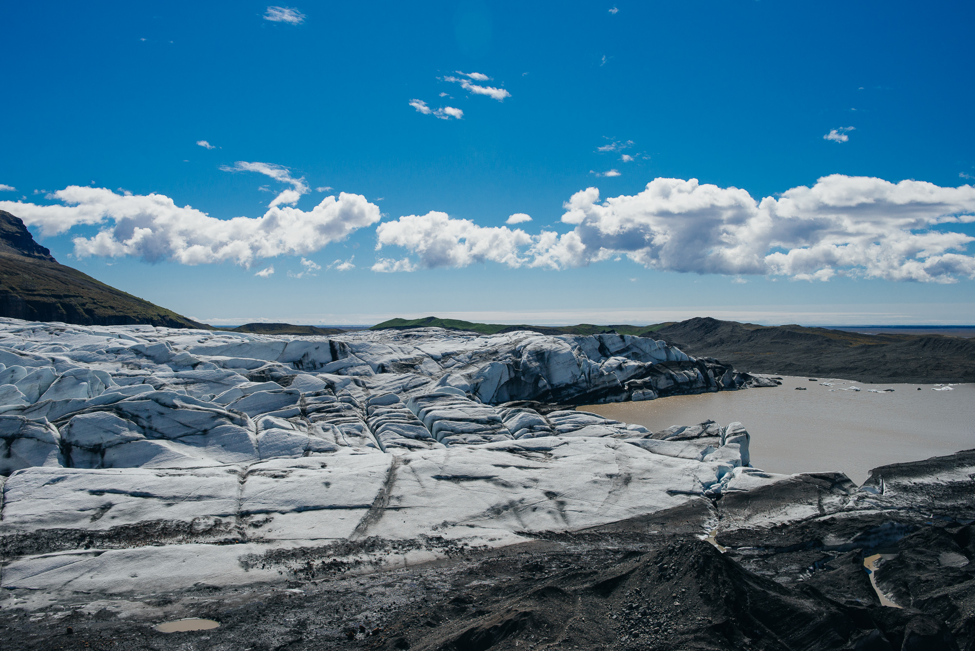
As we were approaching Höfn an amazing scene opened for us - outlet glaciers flowing from Vatnajökull, the largest ice cap in Iceland with an area of 8,100 km² - covering more than 8% of the country.


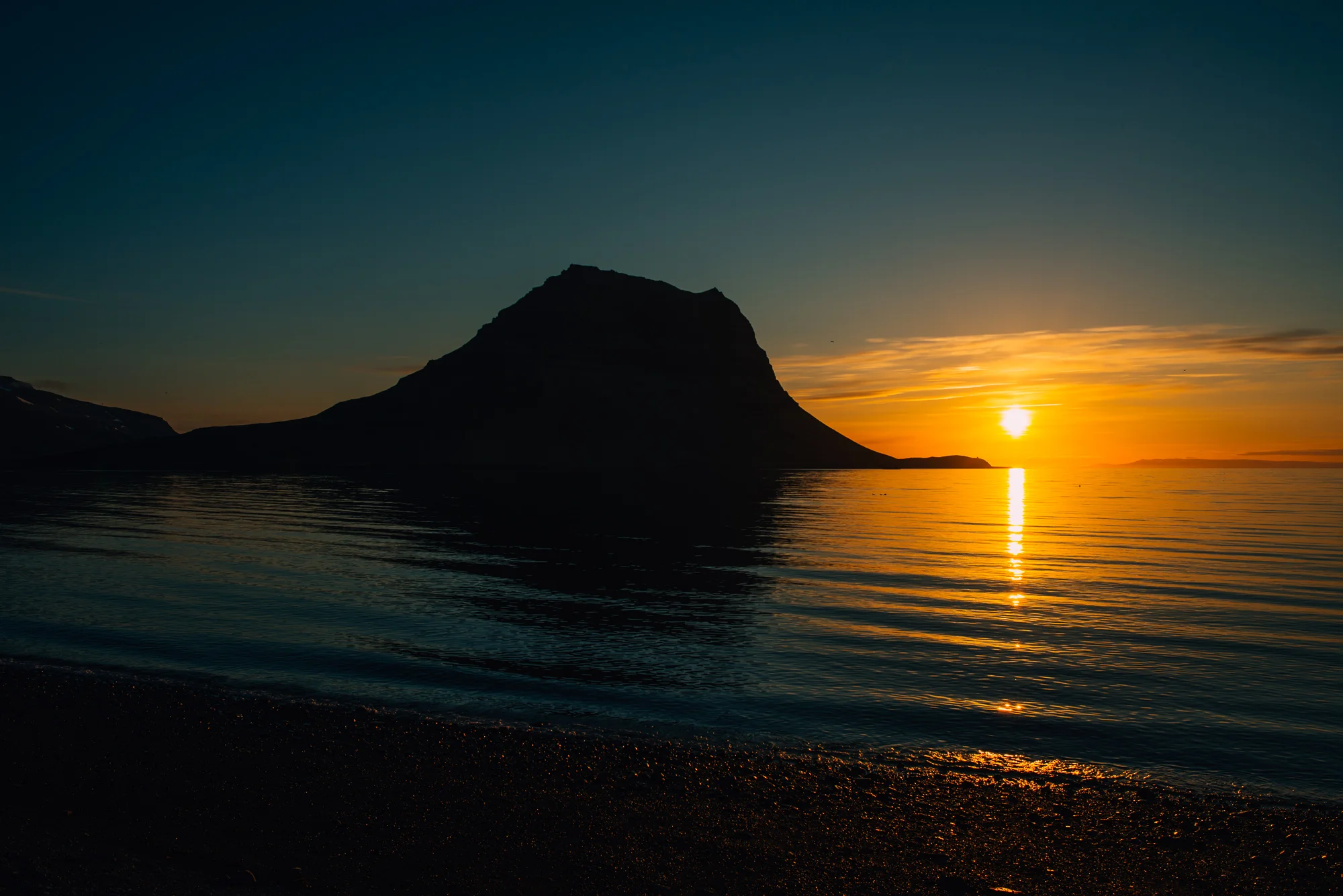
Höfn hostel was the least pleasant stay, kind of like a nuclear shelter, but still fine. We didn’t stay inside very long - the day ended with a walk around town and the view over glacier tongues with sun setting behind Vatnajökull.
Day 11
We left Höfn for South Iceland and there was a busy day ahead of us. As we went south, the landscape turned more vibrant with greener grass and glaciers in the backdrop. Our first stop was Jökulsárlón, a large glacial lake with icebergs floating around, situated at the head of the Breiðamerkurjökull glacier. It's a very popular tourist attraction and consequently the most crowded place we visited - it is a beautiful spot nonetheless. There's black sand beach just across the road and it’s filled with crystal clear icebergs, washed up from the sea. We drove for only 10 minutes to reach another lagoon - Fjallsárlón, a considerably less touristy place, offering similar experience.

Greener eastern parts.


Black icy beach at Jökulsárlón.


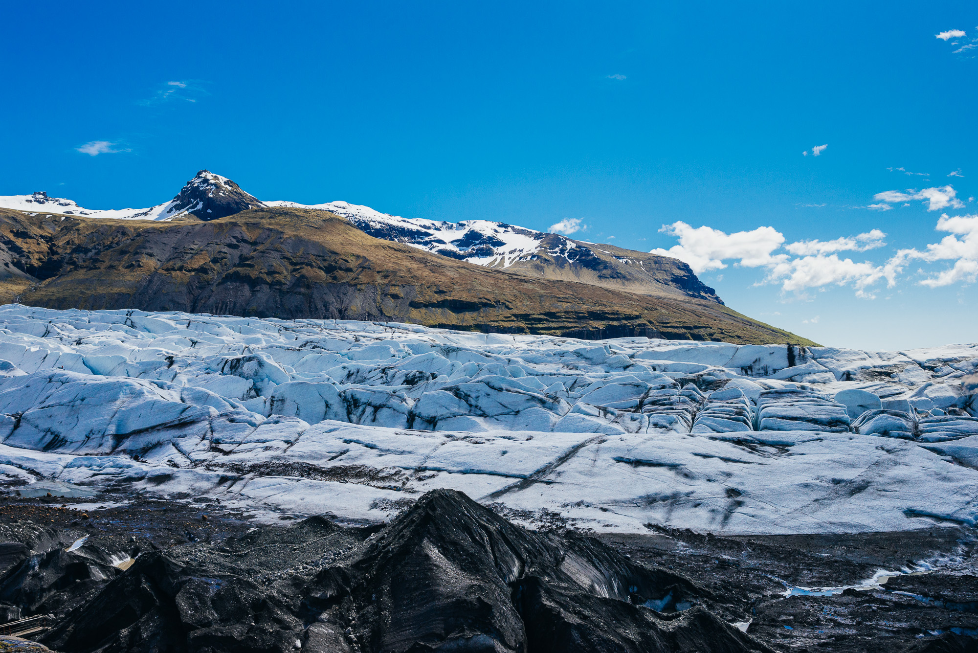
Driving on Route 1, we turned right on Svinafellsjokulsvegur and parked at the end of the gravel road. Just a minute from the parking lot, one can already see the Svínafellsjökull, an enormous mass of ice. I think this might be the most reachable glacier tongue. It’s not really as big as the others, but standing right by its edge it looks colossal! We sat down and listened to sounds of ice cracking. Seeing a glacier up close and personal like that is really special. This could've been my favourite place.

Svínafellsjökull.

Next stop: Skaftafell National Park. It actually became a part of the newly established Vatnajökull National Park in 2008. Scenic landscape and a selection of hiking trails make Skaftafell an ideal destination for those who like to enjoy outdoor activities in nature. It's also the perfect base camp for those who seek to climb Iceland‘s highest mountain peak, Hvannadalshnjúkur. We only took a short trail leading to Svartifoss (Black waterfall), surrounded by distinctive dark lava columns. With all the waterfalls, you’d think you’d grow tired of them. On the contrary!
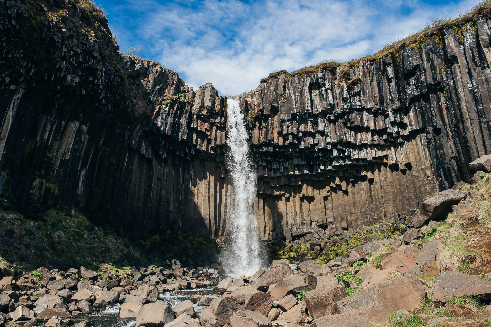
Svartifoss.
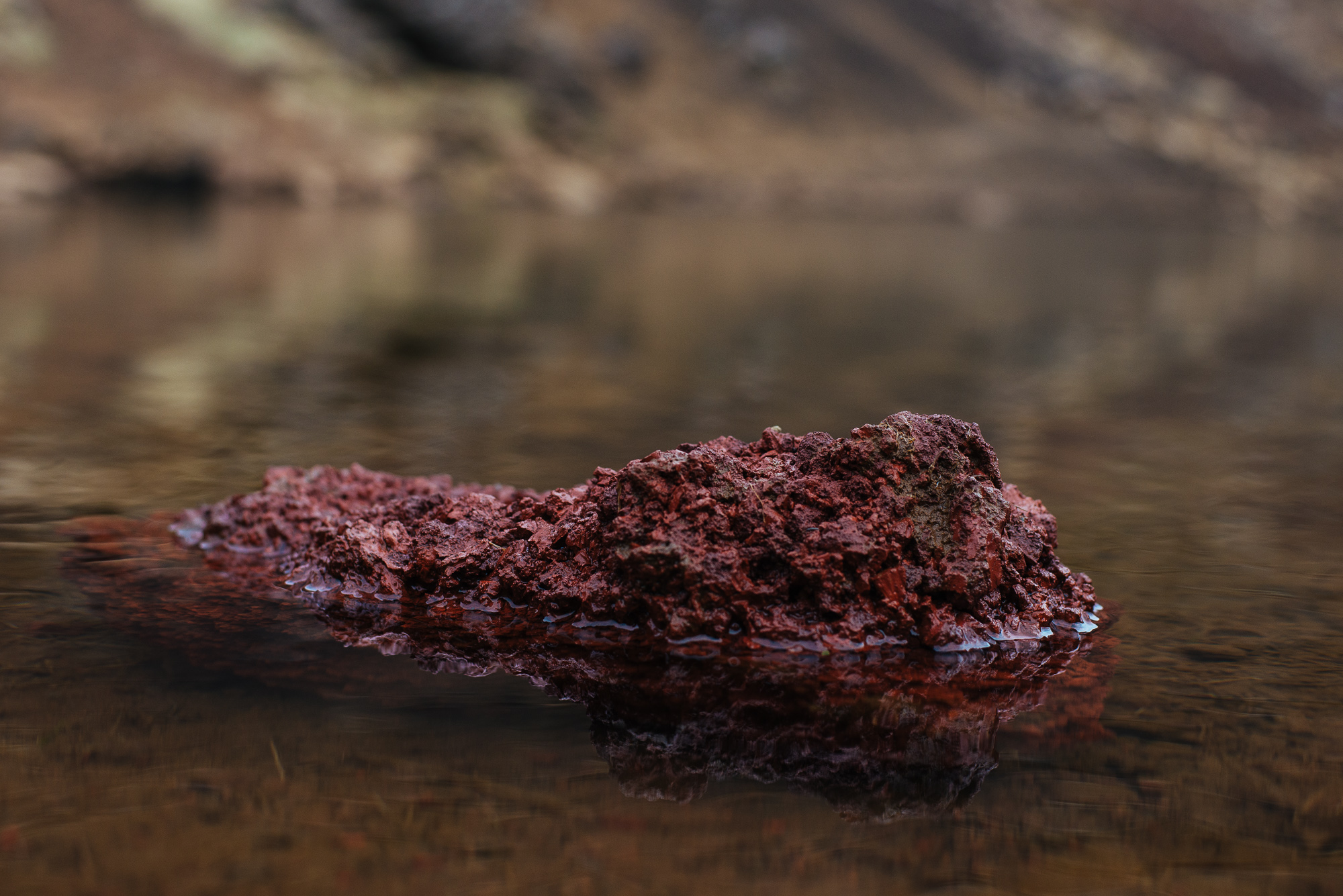
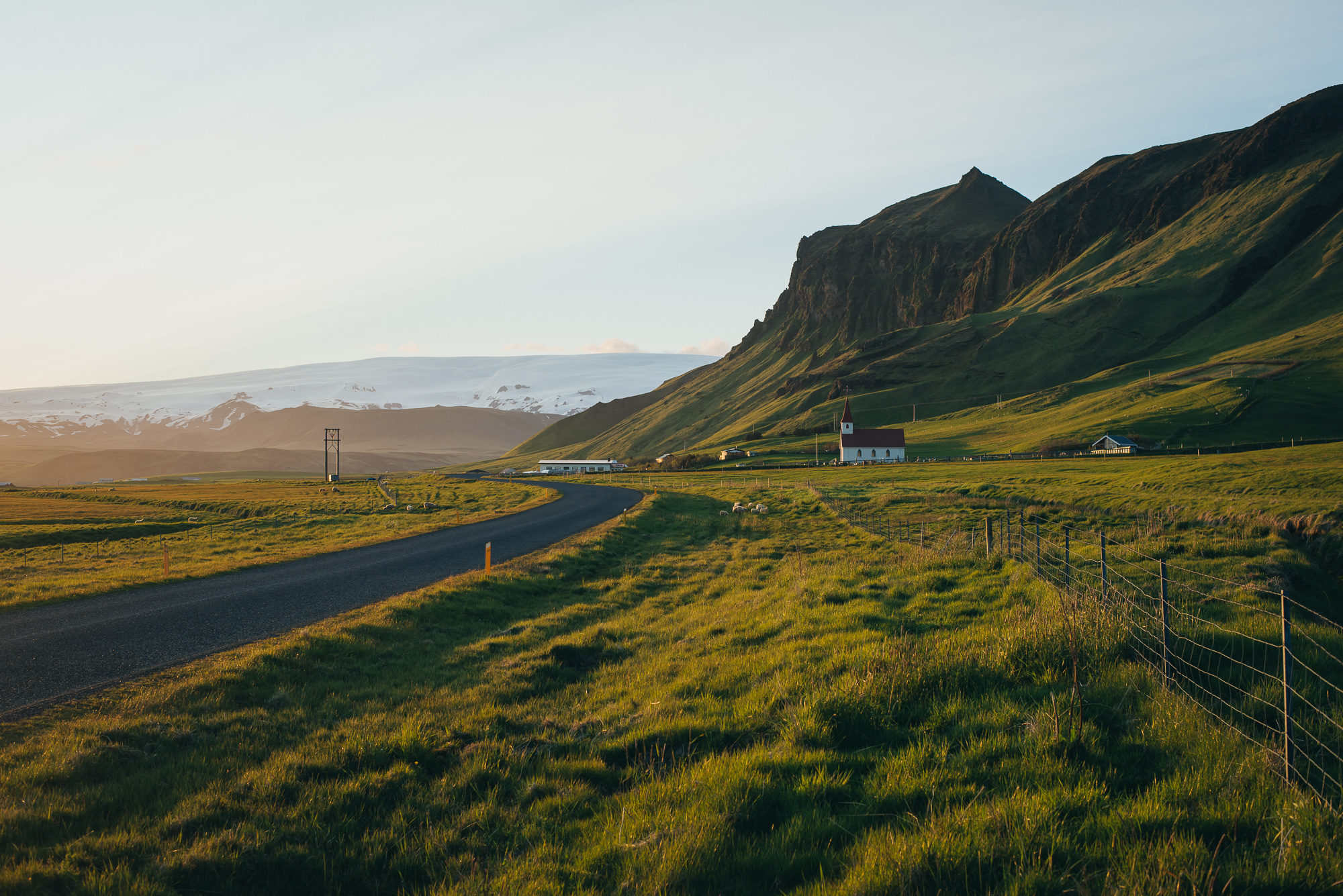
We continued our trip going south, passing a backyard waterfall Foss á Siðu and Kirkjubæjarklaustur. We check out a serpentine moss-covered canyon Fjaðrárgljúfur. I presume it looks best later in the summer, when moss reaches a more saturated green.


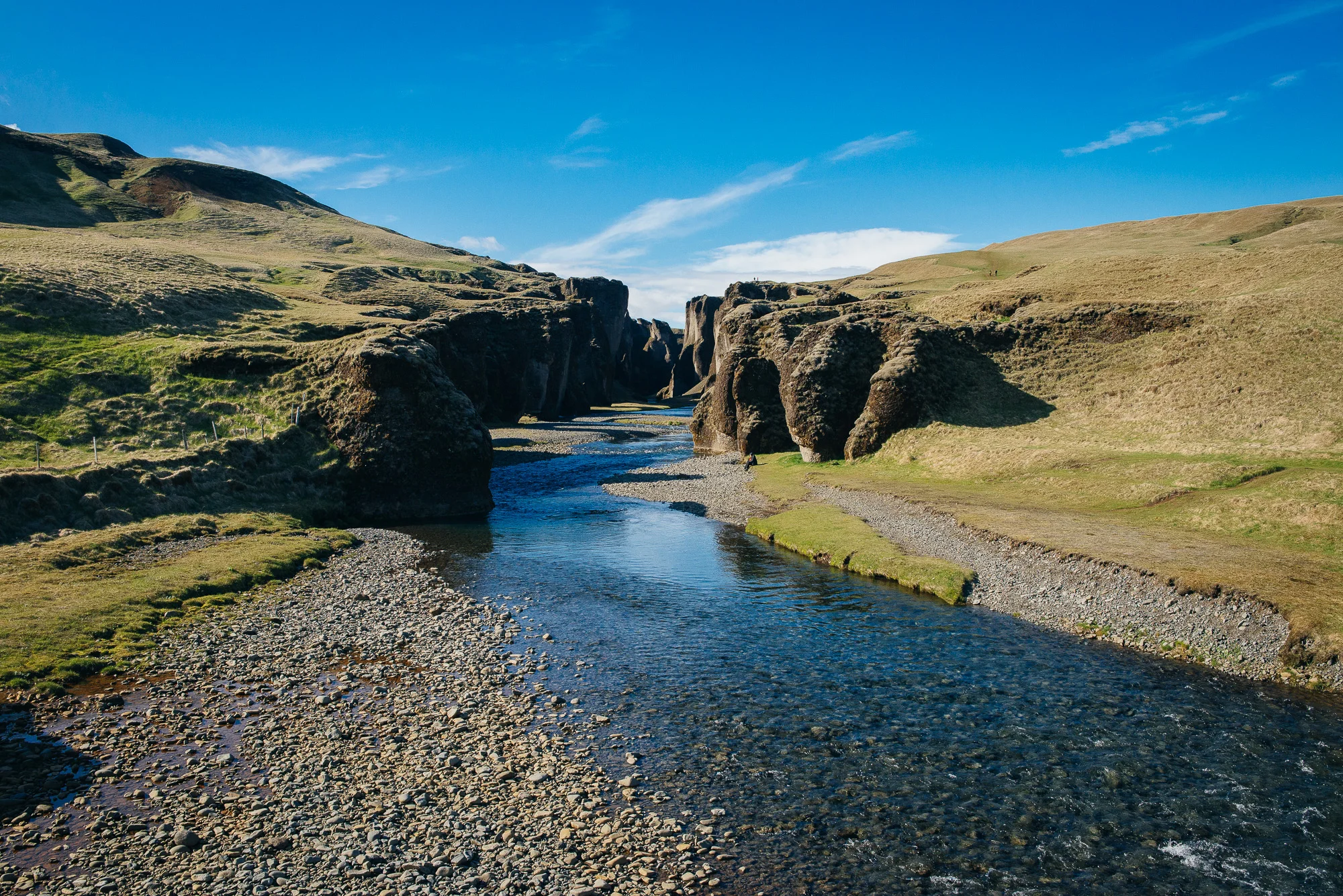
Fjaðrárgljúfur.


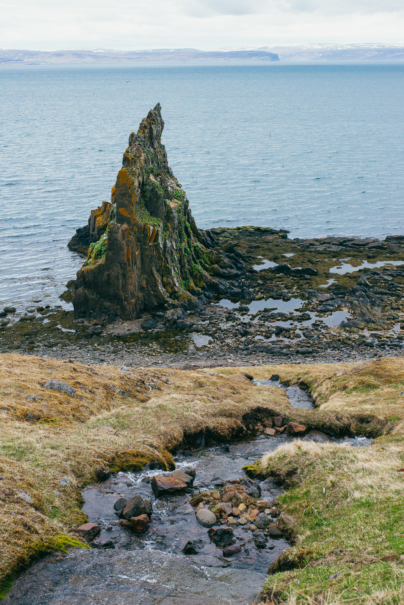
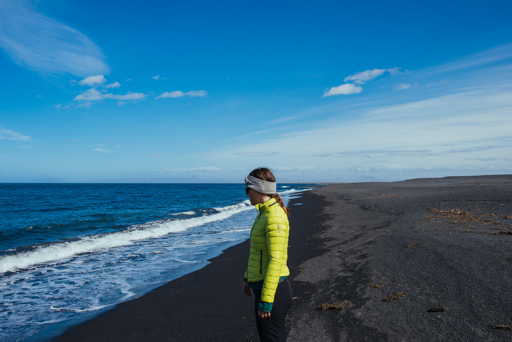
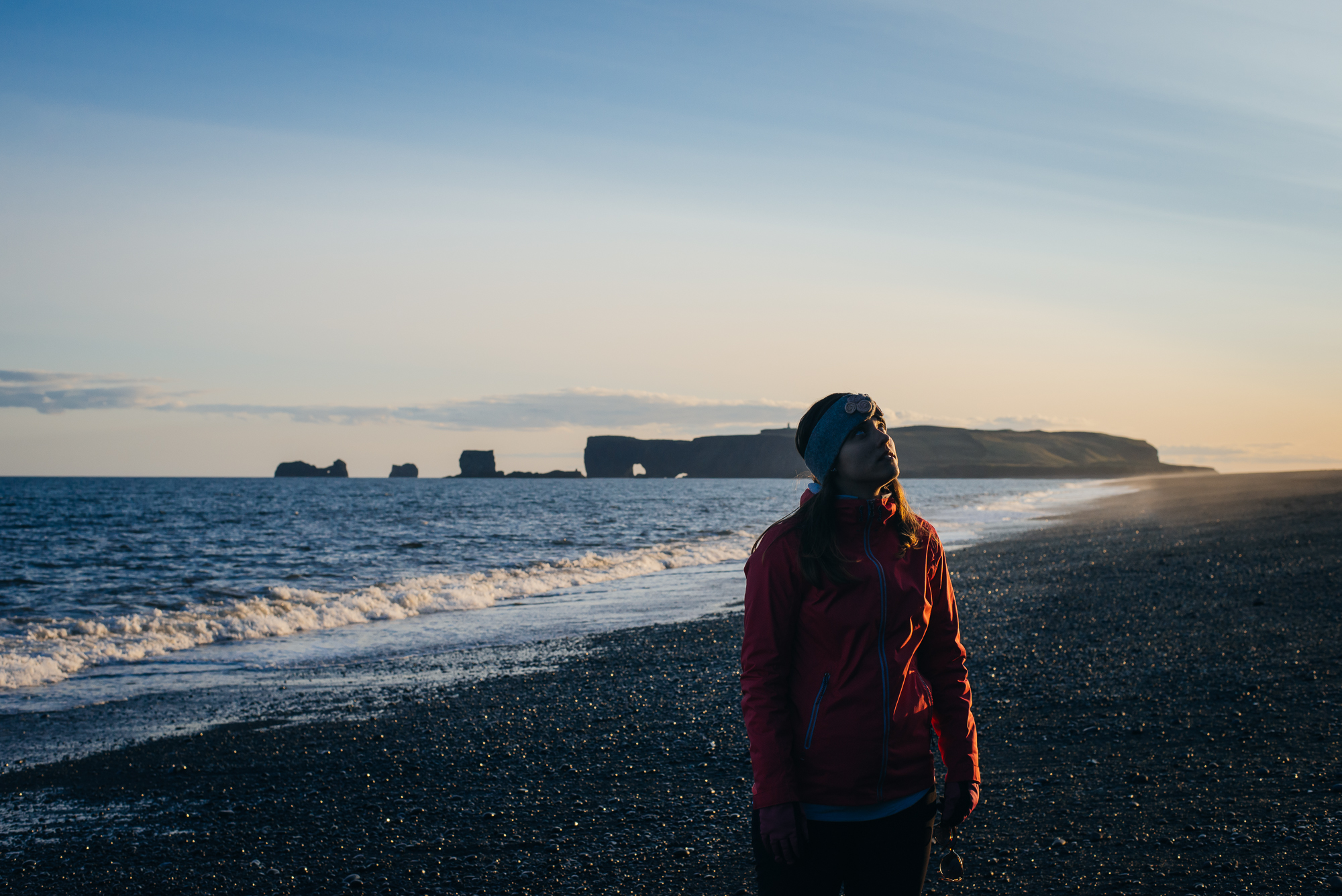
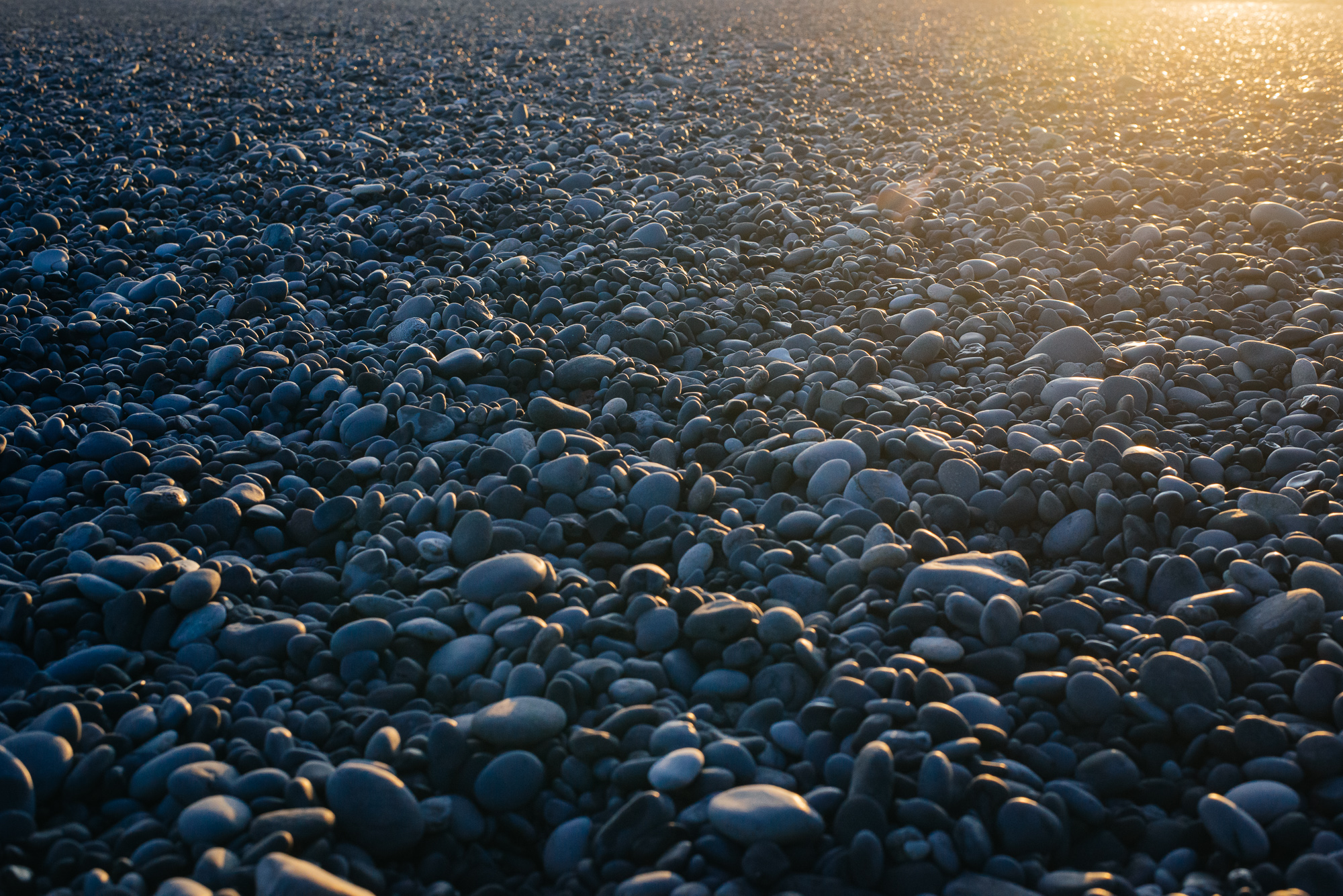
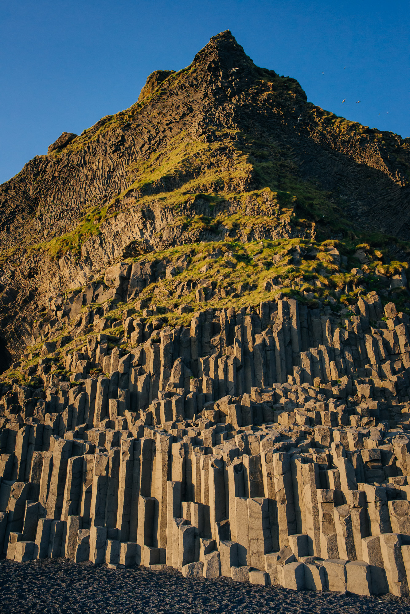
We reached Vík í Mýrdal in the evening. Vík hostel was probably my favourite - lovely people with a cool dorm, bathroom and kitchen. We had dinner and headed right back out as the evening light was about to shine. We circled around the cliff to check Reynisfjara beach, columnar basalt cave Halsanefshellir and basalt sea stacks Reynisdrangar. Legend says that the stacks were formed when two trolls dragged a three-masted ship to land unsuccessfully and daylight petrified them.
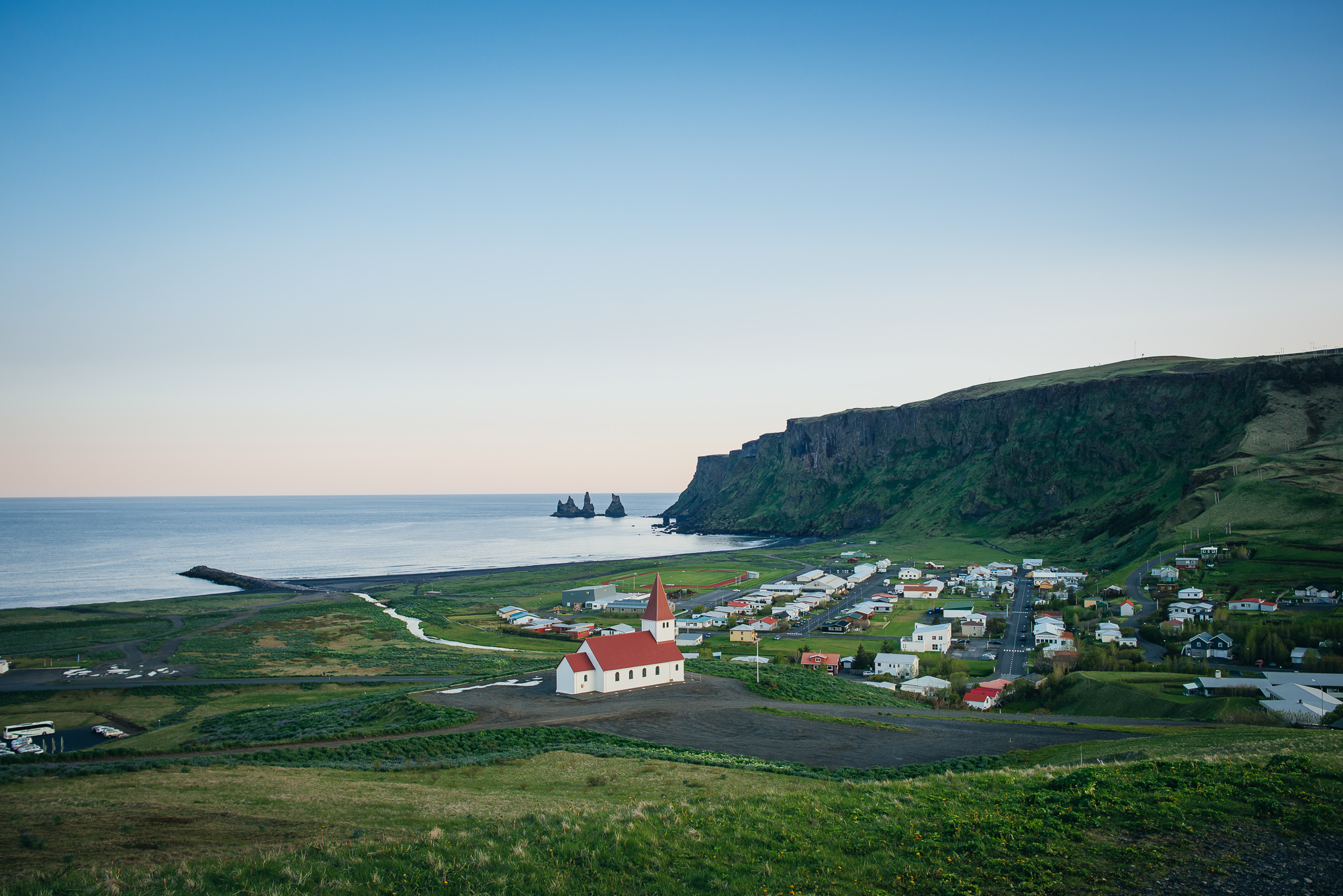
Overlooking Vík í Mýrdal.


Day 12
Our Iceland adventure was slowly ending and we had one whole day of exploring left. We were cruising up the southern coast, starting with the nearby peninsula Dyrhólaey - a very intriguing piece of arched rock with great views all around. We caught another ash-covered outlet glacier quite close to the main road - Sólheimajökull, belonging to Mýrdalsjökull.

Reynisfjara.


Continuing on Route 1 we visited the beautiful Skógafoss waterfall at the cliffs of the former coastline. A single or even double rainbow is quite common as the waterfall produces a great amount of spray.
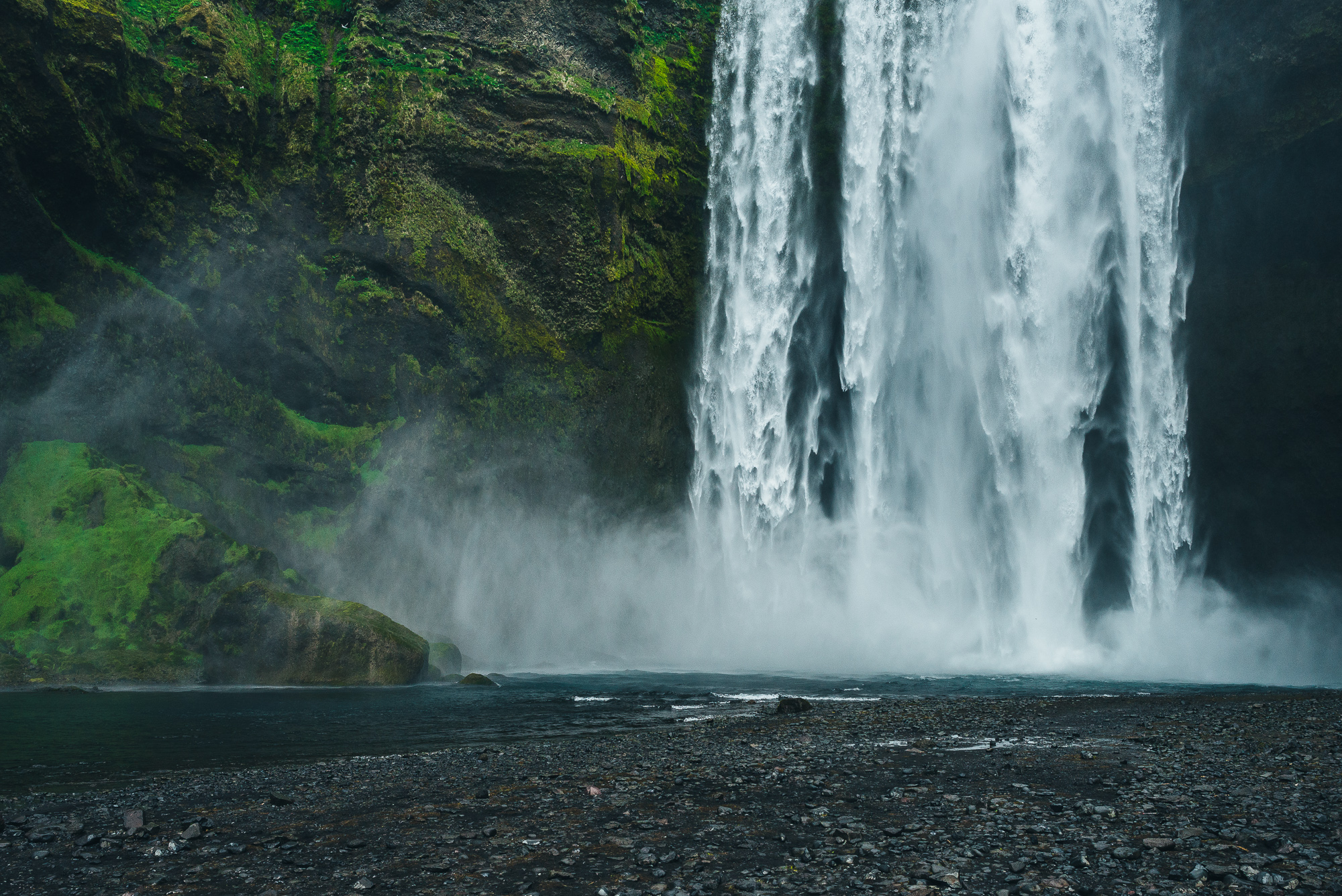
Skógafoss.


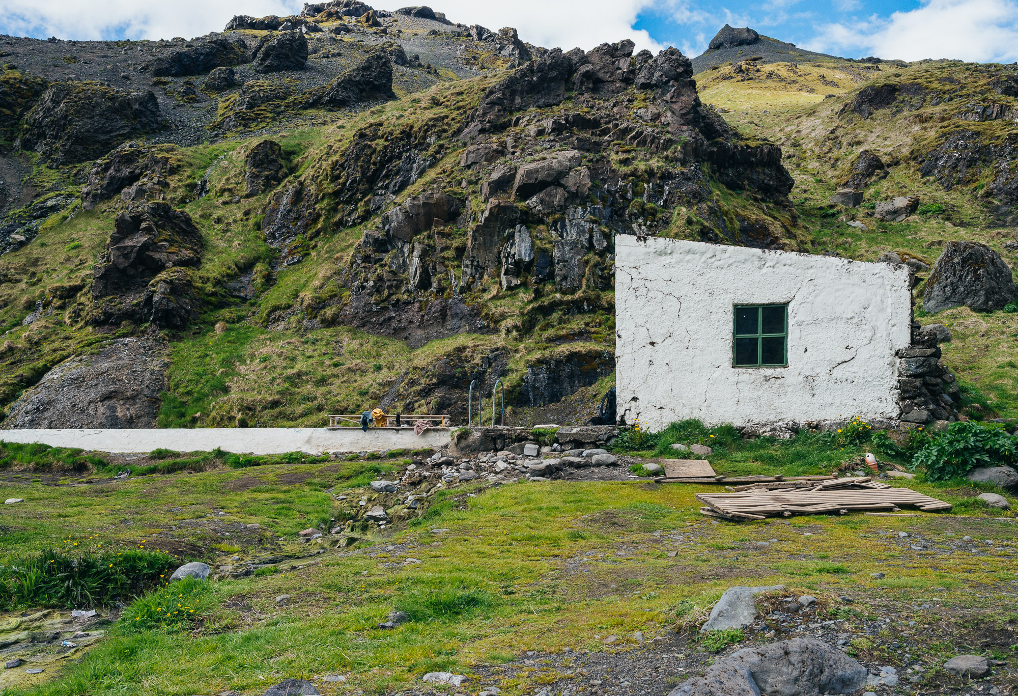
Next - a "secret" pool. We detached from Rt. 1 onto Rt. 242 and entered a green narrow valley below the infamous Eyjafjallajökull. 15 minute walk from the carpark brought us to Seljavallalaug pool. It's the oldest (still standing) pool in Iceland, built in 1923. The water is pleasantly warm as it comes from a natural hot spring close by. Don’t forget to take a dip in the river next to the pool, it’s a bit colder. Just a bit.

Seljavallalaug.


We passed Eyjafjallajökull visitor centre looking right to the glacier covering a volcano, which errupted in 2010 and caused enormous disruption to air travel across western and northern Europe.
We then visited a series of waterfalls from Seljalandsfoss to Gljúfrafoss. Quite crowded and for a good reason. The highlight is Seljalandsfoss, where water falls 60 metres over the cliffs of the former coastline. It's special in that it’s possible to walk behind the waterfall.

Seljalandsfoss.


Day 13
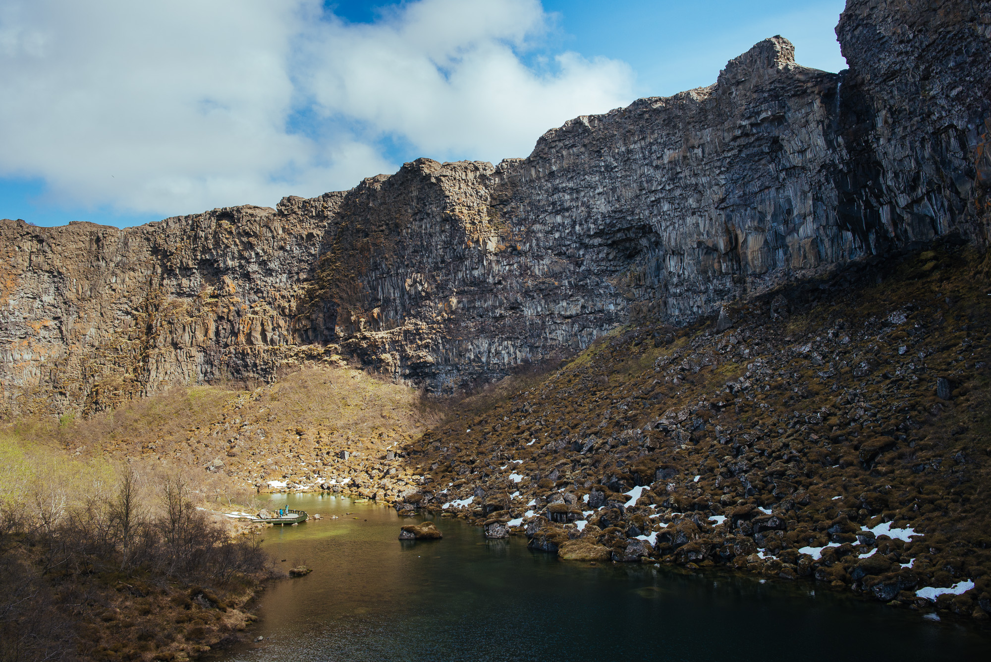
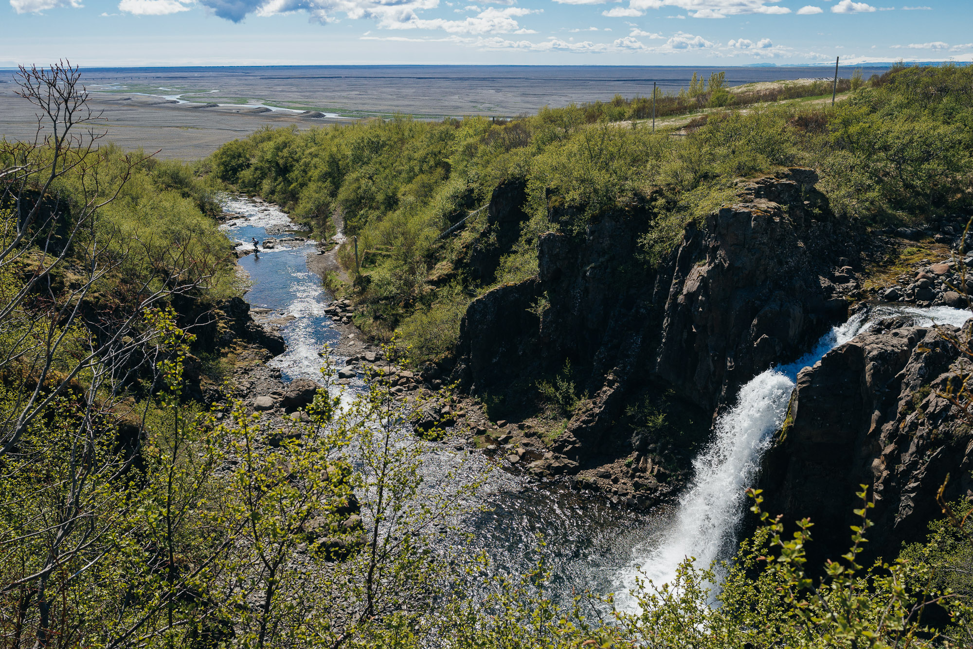
The final day. We checked out of the cozy Vík hostel and headed back to Keflavik. But not before Gjáin and possibly Háifoss. We detached to the right after Hella and drove past an active volcano Hekla (Hooded One). During the Middle Ages it was commonly believed to be the gateway to hell. We arrived at Gjáin, a beautiful, quite distant and unknown place full of little waterfalls, ponds and volcanic rock formations. We really wanted to reach the amazing Háifoss waterfall, but Rt. 327 was in bad condition.

Gjáin.


We set course for Reykjanes peninsula and the Blue Lagoon. Turns out we’d have to have bought the tickets in advance as it was full. We turned around, drove to Reykjavik and went swimming in Laugardalur swimming pool. A perfect end of the day and our trip. Till next time.
I can't wait for my next Icelandic adventure. The sooner the better. I'd probably choose winter for the second time as I'd very much like to see aurora borealis at least once in my lifetime! Westfjords would definitely be on my list, however the late summer Laugavegur hiking trail from Landmannalaugar to the glacial valley of Þórsmörk sounds even better. South Iceland's Laki craters are also an amazing sight. I could go on and on.
We planned our trip with information from plentiful Icelandic travel websites: www.visiticeland.com, www.inspiredbyiceland.is, www.visitreykjavik.is, www.westiceland.is, www.westfjords.is, www.northiceland.is, www.east.is, www.south.is, www.visitreykjanes.is, www.icelandtravel.is etc. Lonely Planet, Rough Guides and Wikitravel also helped us big time. I'd also like to mention I Heart Reykjavík blog, they're doing an amazing job!
I have a Google map with all the interest points, including the ones we couldn't visit, let me know if you want me to share it.